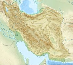
| Hamun-e Jaz Murian | |
|---|---|
| Coordinates | 27°29′27″N 58°32′46″E / 27.4908°N 58.5461°E |
| Type | Seasonal salt (hypersaline) lake |
| Primary inflows | Bampur River, Halil River |
| Primary outflows | none: all water entering the lake is lost through evaporation |
| Basin countries | Iran |
| Surface area | 3,300 km2 (1,300 sq mi) |

Hamun-e Jaz Murian (Persian: هامون جازموریان) is an inland basin or depression in southeast Iran, straddling the provinces of Kerman and Sistan-Baluchistan. The area of Hamoon and Jazmourian basin stretches to 69,600 square kilometers, with the western part of 35,600 square kilometers in Kerman province and the eastern part of 34,000 square kilometers in Sistan-Baluchestan province.
The Jazmurian Wetland is located in an endorheic basin at the southern edge of the Dasht-e-Lut. Several factors such as high evaporation, overexploitation of groundwater, dam construction on the rivers feeding the wetland, and the effect of drought and climate changes have caused this wetland to dry out during the recent years.
