Harqin Left Wing
ᠬᠠᠷᠠᠴᠢᠨ ᠰᠢᠶᠠᠨ 喀喇沁县 Harqin, Kazuo | |
|---|---|
| ᠬᠠᠷᠠᠴᠢᠨ ᠵᠡᠭᠦᠨ ᠭᠠᠷᠤᠨ ᠮᠣᠩᠭᠣᠯ ᠦᠨᠳᠦᠰᠦᠲᠡᠨ ᠦ ᠥᠪᠡᠷᠲᠡᠭᠡᠨ ᠵᠠᠰᠠᠬᠤ ᠰᠢᠶᠠᠨ 喀喇沁左翼蒙古族自治县 Harqin Left Wing Mongolian Autonomous County | |
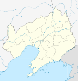
 Location in Chaoyang City | |
| Coordinates: 41°08′N 119°44′E / 41.133°N 119.733°E | |
| Country | China |
| Province | Liaoning |
| Prefecture-level city | Chaoyang |
| County seat | Dachengzi Subdistrict |
| Area | |
| • Total | 2,240 km2 (860 sq mi) |
| Elevation | 327 m (1,073 ft) |
| Population (2020 census)[1] | |
| • Total | 346,133 |
| • Density | 150/km2 (400/sq mi) |
| Time zone | UTC+8 (China Standard) |
| Postal code | 122300 |
| Website | www |
| Harqin Left Wing Mongolian Autonomous County | |||||||
|---|---|---|---|---|---|---|---|
| Chinese name | |||||||
| Simplified Chinese | 喀喇沁左翼蒙古族自治县 | ||||||
| Traditional Chinese | 喀喇沁左翼蒙古族自治縣 | ||||||
| |||||||
| Harqin County | |||||||
| Simplified Chinese | 喀喇沁县 | ||||||
| Traditional Chinese | 喀喇沁縣 | ||||||
| |||||||
| Kazuo County | |||||||
| Simplified Chinese | 喀左县 | ||||||
| Traditional Chinese | 喀左縣 | ||||||
| |||||||
| Mongolian name | |||||||
| Mongolian script | ᠬᠠᠷᠠᠴᠢᠨ ᠵᠡᠭᠦᠨ ᠭᠠᠷᠤᠨ ᠮᠣᠩᠭᠣᠯ ᠦᠨᠳᠦᠰᠦᠲᠡᠨ ᠦ ᠥᠪᠡᠷᠲᠡᠭᠡᠨ ᠵᠠᠰᠠᠬᠤ ᠰᠢᠶᠠᠨ | ||||||
Harqin Left Wing Mongolian Autonomous County[2] (Chinese: 喀喇沁左翼蒙古族自治县), also abbreviated as Harqin County or Kazuo County, is a Mongolian autonomous county in the west of Liaoning province, China. It is under the administration of Chaoyang City, 77 km (48 mi) to the northeast, and has a population of 420,000[when?] residing in an area of 2,240 km2 (860 sq mi). Formerly known as Harqin Left Wing Banner (喀喇沁左翼旗).
- ^ "朝阳市第七次全国人口普查公报" (in Chinese). Government of Chaoyang. 2021-06-16.
- ^ "Harqin Left Wing Mongolian folklore". China Daily. 2006-11-21.
Harqin Left Wing Mongolian autonomous county, Liaoning province
