| Harris Neck National Wildlife Refuge | |
|---|---|
IUCN category IV (habitat/species management area) | |
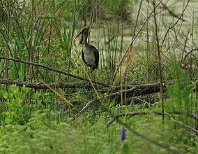
 A juvenile white ibis in the Harris Neck National Wildlife Refuge | |
| Location | McIntosh County, Georgia, United States |
| Nearest city | Riceboro, Georgia |
| Coordinates | 31°38′00″N 81°16′00″W / 31.63333°N 81.26667°W |
| Area | 2,762 acres (11.18 km2) |
| Established | 1962 |
| Governing body | U.S. Fish and Wildlife Service |
| Website | Harris Neck National Wildlife Refuge |
 | |
Harris Neck National Wildlife Refuge was established in 1962. It consists of 2,762 acres (11.18 km2) of saltwater marsh, grassland, mixed deciduous woods, and cropland located on an abandoned military airfield in McIntosh County, Georgia, north of the intersection of Route 131 and Harris Neck Airport Road, about 30 miles (48 km) southwest of Savannah, Georgia.

