| |
|---|---|
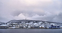
 View of the town | |
 | |
| Coordinates: 68°48′04″N 16°32′39″E / 68.80112°N 16.54414°E | |
| Country | Norway |
| Region | Northern Norway |
| County | Troms |
| District | Central Hålogaland |
| Municipality | Harstad Municipality |
| Established as | |
| Town (By) | 1904 |
| Area | |
| • Total | 11.45 km2 (4.42 sq mi) |
| Elevation | 3 m (10 ft) |
| Population (2023)[2] | |
| • Total | 21,289 |
| • Density | 1,858/km2 (4,810/sq mi) |
| Time zone | UTC+01:00 (CET) |
| • Summer (DST) | UTC+02:00 (CEST) |
| Post Code | 9405 Harstad |
| Harstad ladested | |
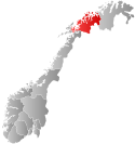
 Troms within Norway | |
 Harstad within Troms | |
| Country | Norway |
| County | Troms |
| District | Central Hålogaland |
| Established | 1904 |
| • Preceded by | Trondenes Municipality |
| Disestablished | 1 Jan 1964 |
| • Succeeded by | Harstad Municipality |
| Administrative centre | Harstad |
| Area (upon dissolution) | |
| • Total | 0.7 km2 (0.3 sq mi) |
| • Rank | #679 in Norway |
| Population (1963) | |
| • Total | 3,860 |
| • Rank | #231 in Norway |
| • Density | 5,514/km2 (14,280/sq mi) |
| • Change (10 years) | |
| ISO 3166 code | NO-1901[4] |
Harstad (Norwegian, pronounced [hɐ̞̂ɻ.ʃt̠ɐ̞] ) or Hárstták (Northern Sami)[5][6] is a city[1] in Harstad Municipality in Troms county, Norway. The city is also the administrative centre of Harstad Municipality. The 11.46-square-kilometre (2,830-acre) city has a population (2023) of 21,289 (31,404 in the Urban area) and a population density of 1,858 inhabitants per square kilometre (4,810/sq mi). [2] It is the second-largest town in Troms county, after the city of Tromsø, and it is the largest town in Central Hålogaland.[7]
The town is located on the northeastern part of the large island of Hinnøya, along the Vågsfjorden. The city is made up of several areas (bydeler) including Gansås, Grønnebakkan, Kanebogen, Medkila, Sama, Seljestad, Stangnes, and Trondenes and more. There are two churches of the Church of Norway in the town: Harstad Church and Kanebogen Church. The historic Trondenes Church lies on the north edge of the town, near the Trondenes Fort.
- ^ a b In the Norwegian language, the word by can be translated as "town" or "city".
- ^ a b c Statistisk sentralbyrå (2023-12-23). "Urban settlements. Population and area, by municipality".
- ^ "Harstad, Harstad (Troms)". yr.no. Retrieved 2018-09-01.
- ^ Bolstad, Erik; Thorsnæs, Geir, eds. (2023-01-26). "Kommunenummer". Store norske leksikon (in Norwegian). Kunnskapsforlaget.
- ^ "Informasjon om stadnamn". Norgeskart (in Norwegian). Kartverket. Retrieved 2024-07-28.
- ^ Cite error: The named reference
sami namewas invoked but never defined (see the help page). - ^ Thorsnæs, Geir, ed. (2018-02-21). "Harstad". Store norske leksikon (in Norwegian). Kunnskapsforlaget. Retrieved 2018-09-01.


