Hathras district | |
|---|---|
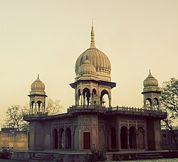
 Hathras Tample | |
 Location of Hathras district in Uttar Pradesh | |
| Country | |
| State | Uttar Pradesh |
| Division | Aligarh |
| Headquarters | Hathras |
| Government | |
| • Lok Sabha constituencies | Hathras |
| Area | |
| • Total | 1,840 km2 (710 sq mi) |
| Population (2011) | |
| • Total | 1,564,708 |
| • Density | 850/km2 (2,200/sq mi) |
| Demographics | |
| • Literacy | 71.6% |
| • Sex ratio | 871 |
| Time zone | UTC+05:30 (IST) |
| Website | https://hathras.nic.in/ |
Hathras district (previously called Mahamaya Nagar district)[1] is a district of Uttar Pradesh state of India.[2] The city of Hathras is the district headquarters. Hathras district is a part of Aligarh division. The district occupies an area of 1,840 square kilometres (710 sq mi) and has a population of 1,564,708 as of the 2011 census.
- ^ Sharat Pradhan (23 July 2012). "Akhilesh renames 8 major districts carved out by Mayawati - Rediff.com India News". rediff.com. Retrieved 10 February 2021.
when she carved out Mahamaya Nagar out of Ghaziabad district ... Akhilesh has now renamed the district as Hathras
- ^ "Important Cabinet Decisions". Information and Public Relations Department. Archived from the original on 24 October 2014. Retrieved 17 January 2013.