| Heanor and Loscoe | |
|---|---|
| Civil parish | |
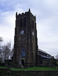
 St Lawrence's Church, Heanor | |
 Parish map | |
Location within Derbyshire | |
| Area | 2.34 sq mi (6.1 km2) [1] |
| Population | 17,337 (2021) |
| • Density | 7,409/sq mi (2,861/km2) |
| OS grid reference | SK 4347 |
| • London | 120 mi (190 km) SE |
| District | |
| Shire county | |
| Region | |
| Country | England |
| Sovereign state | United Kingdom |
| Settlements | Heanor, Loscoe, Marlpool, Langley, Loscoe Grange |
| Post town | HEANOR |
| Postcode district | DE75 |
| Dialling code | 01773 |
| Police | Derbyshire |
| Fire | Derbyshire |
| Ambulance | East Midlands |
| UK Parliament | |
| Website | www.heanorloscoe |
Heanor and Loscoe is a civil parish within the Amber Valley district, which is in the county of Derbyshire, England. Mainly built up with rural fringes, its population was 17,337 during the 2021 census,[1] a small increase from the 17,251 residents of the 2011 census.[2] The parish is 120 miles (190 km) north west of London, 10 miles (16 km) north east of the county city of Derby,[3] and contains the market town of Heanor along with other areas.[4] It shares a boundary with the parishes of Aldercar and Langley Mill, Codnor, Denby, Shipley and Smalley.[5]
- ^ a b UK Census (2021). "2021 Census Area Profile – Heanor and Loscoe parish (E04002674)". Nomis. Office for National Statistics.
- ^ UK Census (2011). "Local Area Report – Heanor and Loscoe (E04002674)". Nomis. Office for National Statistics.
- ^ "PROFILE and 2011 CENSUS OF HEANOR AND LOSCOE TOWN COUNCIL" (PDF).
- ^ "Strategic Housing Land Availability Assessment Amber Valley - Derbyshire County Council". www.derbyshire.gov.uk. Retrieved 2023-01-12.
- ^ "Heanor and Loscoe". Ordnance Survey.
