Flag of Australia, used for Heard Island and the McDonald Islands[1] A southwesterly view of Heard Island in 2009. | |
 | |
| Geography | |
|---|---|
| Location | Indian Ocean |
| Major islands | 2 |
| Area | 368 km2 (142 sq mi) |
| Highest elevation | 2,745 m (9006 ft) |
| Highest point | Mawson Peak |
| Administration | |
| Demographics | |
| Population | 0 (2000) |
| Criteria | Natural: viii, ix |
| Reference | 577 |
| Inscription | 1997 (21st Session) |
| Area | 658,903 ha (2544 sq. mi.) |
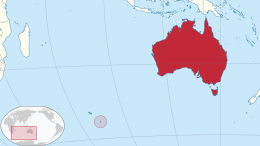
The Territory of Heard Island and McDonald Islands[2][3] (HIMI;[4] ISO 3166 region code: HMD, HM, 334;[5]) is an Australian external territory comprising a volcanic group of mostly barren Antarctic islands, about two-thirds of the way from Madagascar to Antarctica. The group's overall land area is 372 km2 (144 sq mi) and it has 101.9 km (63 mi) of coastline. Discovered in the mid-19th century, the islands lie on the Kerguelen Plateau in the Indian Ocean and have been an Australian territory since 1947.
Heard Island and McDonald Islands contain Australia's only two active volcanoes. The summit of one, Mawson Peak, is higher than any mountain in all other Australian states, territories or claimed territories, except Dome Argus, Mount McClintock and Mount Menzies in the Australian Antarctic Territory. This Antarctic territory is a land claim unrecognised by most other countries,[6] meaning that Mawson Peak is the highest mountain over which Australia has true sovereignty.
The islands are among the most remote places on Earth: They are located about 4,100 kilometres (2,200 nautical miles) southwest of Perth,[7] 3,850 km (2,080 nmi) southwest of Cape Leeuwin, Australia, 4,200 km (2,300 nmi) southeast of South Africa, 3,830 km (2,070 nmi) southeast of Madagascar, 1,630 km (880 nmi) north of Antarctica, and 450 km (240 nmi) southeast of the Kerguelen Islands (part of French Southern and Antarctic Lands).[8]
The islands, which are uninhabited, can be reached only by sea, which from Australia takes two weeks in the vessels normally used to access them.[9]
- ^ "The symbols of other territories of Australia". www.pmc.gov.au. Australian Government. 2 September 2022. Archived from the original on 10 October 2024. Retrieved 10 October 2024.
- ^ "Heard Island and McDonald Islands". CIA World Factbook. Retrieved 4 January 2009.
- ^ UNESCO. "Heard and McDonald Islands". Retrieved 31 January 2015.
- ^ Commonwealth of Australia. "About Heard Island – Human Activities". Archived from the original on 18 October 2006. Retrieved 21 October 2006.
- ^ "Heard Island and McDonald Islands". ISO. 26 November 2018.
- ^ "Antarctic Region". U.S. Department of State. Retrieved 14 June 2024.
- ^ "Cocky Flies, Geoscience Australia". Archived from the original on 24 December 2008. Retrieved 29 March 2016.
- ^ "Distance Between Cities Places On Map Distance Calculator". distancefromto.net. Retrieved 29 March 2016.
- ^ "Frequently asked questions". 28 February 2005.

