| Heaton | |
|---|---|
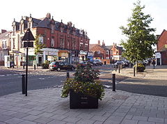
 Chillingham Road, Heaton's main commercial street | |
Location within Tyne and Wear | |
| OS grid reference | NZ273660 |
| • London | 242 mi (389 km) |
| Metropolitan borough | |
| Metropolitan county | |
| Region | |
| Country | England |
| Sovereign state | United Kingdom |
| Post town | NEWCASTLE UPON TYNE |
| Postcode district | NE6-7 |
| Dialling code | 0191 |
| Police | Northumbria |
| Fire | Tyne and Wear |
| Ambulance | North East |
| UK Parliament | |
| Councillors |
|
Heaton is a district and suburb[1] in the city of Newcastle upon Tyne, in Tyne and Wear, England, two miles (three kilometres) east of the city centre. It is bordered by the neighbouring areas of Walkergate to the east, Jesmond to the north west, Byker to the south, and Sandyford to the west. The name Heaton means high town, referring to the area "being situated on hills above the Ouseburn, a tributary of the River Tyne." The area is divided into South Heaton, and High Heaton, representing the north, respectively. For city council elections, the area is split between three wards: Heaton, Manor Park and Ouseburn.[2] Until 1974 it was in Northumberland.
- ^ "Heaton - Visiting Newcastle upon Tyne". Newcastle Tourism Board. Retrieved 27 February 2022.
- ^ "Your Councillors - Newcastle City Council". www.newcastle.gov.uk.
