This article needs additional citations for verification. (February 2020) |
Heinersdorf | |
|---|---|
 Heinersdorf Church | |
| Coordinates: 52°34′01″N 13°26′24″E / 52.56694°N 13.44000°E | |
| Country | Germany |
| State | Berlin |
| City | Berlin |
| Borough | Pankow |
| Founded | 1319 |
| Area | |
| • Total | 3.95 km2 (1.53 sq mi) |
| Elevation | 90 m (300 ft) |
| Population (2023-12-31)[1] | |
| • Total | 8,859 |
| • Density | 2,200/km2 (5,800/sq mi) |
| Time zone | UTC+01:00 (CET) |
| • Summer (DST) | UTC+02:00 (CEST) |
| Postal codes | 13089 |
| Vehicle registration | B |
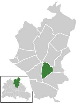
Heinersdorf (German: [ˈhaɪnɐsˌdɔʁf] ) is a locality in the borough of Pankow in Berlin, Germany. It is located close to the centre of Pankow.


