Hellevoetsluis | |
|---|---|
 | |
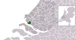
 Location in South Holland | |
| Coordinates: 51°49′N 4°8′E / 51.817°N 4.133°E | |
| Country | Netherlands |
| Province | South Holland |
| Municipality | Voorne aan Zee |
| Area | |
• Total | 61.20 km2 (23.63 sq mi) |
| • Land | 41.10 km2 (15.87 sq mi) |
| • Water | 20.10 km2 (7.76 sq mi) |
| Elevation | 2 m (7 ft) |
| Population (January 2021)[3] | |
• Total | 40,312 |
| • Density | 981/km2 (2,540/sq mi) |
| Demonym | Hellevoeter |
| Time zone | UTC+1 (CET) |
| • Summer (DST) | UTC+2 (CEST) |
| Postcode | 3220–3225 |
| Area code | 0181 |
| Website | www |

Hellevoetsluis (Dutch pronunciation: [ˌɦɛləvutˈslœys] ) is a town and former municipality in the west of Netherlands. It is located in Voorne-Putten, South Holland. The former municipality covered an area of 61.20 km2 (23.63 sq mi) of which 20.10 km2 (7.76 sq mi) was water and it included the population centres of Nieuw-Helvoet, Nieuwenhoorn, and Oude en Nieuwe Struiten, all former municipalities.
Hellevoetsluis is located on the Haringvliet with the sea, beach, and dunes close by, on the extreme southern edge of the Rijnmond and Europoort areas, close to the broad Zeeland landscape. The name translates as "lock at the foot of the Helle". The Helle was a small local river that disappeared over time.
On 1 January 2023, the municipality of Hellevoetsluis merged with Brielle and Westvoorne into the new municipality of Voorne aan Zee.
- ^ "Kerncijfers wijken en buurten 2020" [Key figures for neighbourhoods 2020]. StatLine (in Dutch). CBS. 24 July 2020. Retrieved 19 September 2020.
- ^ "Postcodetool for 3221AL". Actueel Hoogtebestand Nederland (in Dutch). Het Waterschapshuis. Archived from the original on 21 September 2013. Retrieved 29 July 2013.
- ^ "Bevolkingsontwikkeling; regio per maand" [Population growth; regions per month]. CBS Statline (in Dutch). CBS. 1 January 2021. Retrieved 2 January 2022.
