Hendry County | |
|---|---|
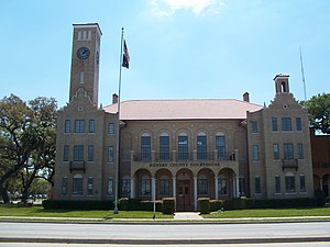
 The Hendry County Courthouse in LaBelle in 2010. | |
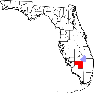
 Location within the U.S. state of Florida | |
 Florida's location within the U.S. | |
| Coordinates: 26°33′N 81°10′W / 26.55°N 81.17°W | |
| Country | |
| State | |
| Founded | May 11, 1923 |
| Named for | Francis A. Hendry |
| Seat | LaBelle |
| Largest city | Clewiston |
| Area | |
| • Total | 1,190 sq mi (3,100 km2) |
| • Land | 1,153 sq mi (2,990 km2) |
| • Water | 37 sq mi (100 km2) 3.1% |
| Population (2020) | |
| • Total | 39,619 |
| • Density | 33/sq mi (13/km2) |
| Time zone | UTC−5 (Eastern) |
| • Summer (DST) | UTC−4 (EDT) |
| Congressional district | 25th |
| Website | www |
Hendry County is a county in the Florida Heartland region of the U.S. state of Florida. As of the 2020 census, the population was 39,619,[1] a 1.2% increase from 39,140 at the 2010 census. The county is majority-Hispanic or Latino.[2] Its county seat is LaBelle.[3]
Hendry County is in the Clewiston micropolitan area, a Micropolitan statistical area (μSA) which also includes Glades County.[4] These two counties, along with the Cape Coral-Fort Myers (Lee County) MSA and the Naples-Marco Island (Collier County) MSA, constitute the Cape Coral-Fort Myers-Naples Combined Statistical Area (CSA).
- ^ "QuickFacts: Hendry County, Florida". United States Census Bureau. Retrieved May 8, 2022.
- ^ "State & County QuickFacts". United States Census Bureau. Retrieved February 14, 2014.[permanent dead link]
- ^ "Find a County". National Association of Counties. Archived from the original on May 31, 2011. Retrieved June 7, 2011.
- ^ "Revised Delineations of Metropolitan Statistical Areas, Micropolitan Statistical Areas, and Guidance on the Uses of the Delineations of These Areas" (PDF). Executive Office of the President. July 21, 2023. p. 91. Retrieved July 27, 2023.
