| High Crag | |
|---|---|
 High Crag from the summit tarn on Haystacks | |
| Highest point | |
| Elevation | 744 m (2,441 ft) |
| Prominence | c. 29 m |
| Listing | Wainwright, Hewitt, Nuttall |
| Coordinates | 54°30′53″N 3°16′05″W / 54.51464°N 3.26814°W |
| Geography | |
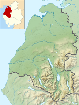
Location in the Lake District National Park | |
| Location | Cumbria, England |
| Parent range | Lake District, Western Fells |
| OS grid | NY180140 |
| Topo map | OS Landranger 89 |
High Crag stands at the southern end of the High Stile ridge which divides the valleys of Ennerdale and Buttermere in the west of the English Lake District. It is often climbed as part of a popular ridge walk, from Black Sail youth hostel, or from Buttermere via Scarth Gap. Panoramas of the Great Gable and the Scafells are visible.


