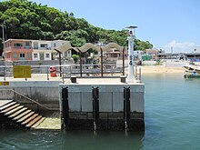


High Island or Leung Shuen Wan Chau (糧船灣洲, Cantonese Yale: lèuhng syùhn wāan hói)[1] is a former island located in the southeast of Sai Kung Peninsula in Hong Kong, within Sai Kung District. Two sets of dams constructed between 1969 and 1979 and crossing the former Kwun Mun Channel (官門海峽), connect the island to the peninsula, thereby forming the High Island Reservoir. Before being connected to the mainland, the island had an area of 8.511 km² (3.29 square miles) and was the 4th largest island of Hong Kong in 1960.[2]
- ^ Schofield, Walter (1983). "The Islands Around Hong Kong (notes for a talk given in 1937)" (PDF). Journal of the Royal Asiatic Society Hong Kong Branch. 23: 9109–110. ISSN 1991-7295.
- ^ Cite error: The named reference
safeguardingwas invoked but never defined (see the help page).