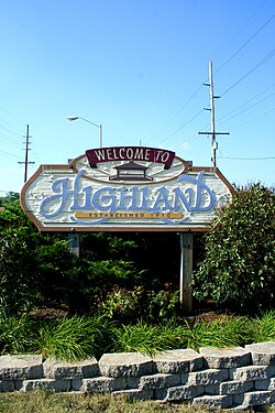
Town of Highland, Indiana | |
|---|---|
 | |
 Location of Highland in Lake County, Indiana. | |
| Coordinates: 41°32′59″N 87°27′29″W / 41.54972°N 87.45806°W | |
| Country | |
| State | |
| County | Lake |
| Township | North |
| Settled | 1848 |
| Incorporated | April 4, 1910 |
| Government | |
| • Type | Town |
| • Body | Town Council |
| • President | Philip Scheeringa (R, 5th) |
| • Vice-President | G. Doug Turich (R, 2nd) |
| • Councilors: | George Georgeff (R, 1st) Alex Robertson (D, 3rd) Thomas Black (R, 4th) |
| • Clerk-Treasurer | Mark Herak (D) |
| Area | |
| • Total | 6.97 sq mi (18.06 km2) |
| • Land | 6.94 sq mi (17.97 km2) |
| • Water | 0.04 sq mi (0.10 km2) |
| Elevation | 623 ft (190 m) |
| Population (2020) | |
| • Total | 23,984 |
| • Density | 3,456.90/sq mi (1,334.78/km2) |
| Standard of living (2008-12) | |
| • Per capita income | $30,036 |
| • Median home value | $155,200 |
| Time zone | UTC−6 (Central) |
| • Summer (DST) | UTC−5 (Central) |
| ZIP code | 46322 |
| Area code | 219 |
| FIPS code | 18-33466[4] |
| GNIS feature ID | 0436149[5] |
| Website | www.highland.in.gov |
| Demographic | Proportion |
|---|---|
| White | 88.6% |
| Black | 4.2% |
| Asian | 1.6% |
| Islander | 0.0% |
| Native | 0.2% |
| Other | 5.4% |
| Hispanic (any race) |
12.8% |
| Census | Pop. | Note | %± |
|---|---|---|---|
| 1910 | 304 | — | |
| 1920 | 542 | 78.3% | |
| 1930 | 1,553 | 186.5% | |
| 1940 | 2,723 | 75.3% | |
| 1950 | 5,878 | 115.9% | |
| 1960 | 16,284 | 177.0% | |
| 1970 | 24,947 | 53.2% | |
| 1980 | 25,935 | 4.0% | |
| 1990 | 23,696 | −8.6% | |
| 2000 | 23,546 | −0.6% | |
| 2010 | 23,727 | 0.8% | |
| 2020 | 23,984 | 1.1% | |
| Source: US Census Bureau | |||
Highland is a town in Lake County, Indiana, United States. The population was 23,984 at the 2020 census. The town was incorporated on April 4, 1910. It is a part of the Chicago metropolitan area and North Township, and is surrounded by Hammond to the north, Munster to the west, Schererville to the south and Griffith to the east.
- ^ "2014 Public Officials Directory". Lake County Board of Elections and Voter's Registration. Retrieved June 10, 2014.
- ^ "2020 U.S. Gazetteer Files". United States Census Bureau. Retrieved March 16, 2022.
- ^ Cite error: The named reference
wwwcensusgovwas invoked but never defined (see the help page). - ^ "U.S. Census website". United States Census Bureau. Retrieved January 31, 2008.
- ^ "US Board on Geographic Names". United States Geological Survey. October 25, 2007. Retrieved January 31, 2008.
- ^ U.S. Census Bureau. American Community Survey, Profile of General Population and Housing Characteristics 2010, Table DP-1, 2010 Demographic Profile Data. U.S. Census website. Retrieved June 14, 2014.