| Hodge Beck | |
|---|---|
 Hodge Beck in Kirkdale | |
| Location | |
| Country | England |
| Counties | North Yorkshire |
| Physical characteristics | |
| Mouth | |
• location | River Dove |
• coordinates | 54°14′18″N 0°55′51″W / 54.2384°N 0.9309°W |
| Length | 23 km (14 mi) |
| Basin size | 58 km2 (22 sq mi) |
| Discharge | |
| • location | Cherry Farm |
| • average | 0.67 m3/s (24 cu ft/s) |
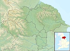
Hodge Beck is a stream that flows through the North York Moors national park in North Yorkshire, England. It is a tributary of the River Dove which it joins near Welburn south of Kirkbymoorside. The beck is 14 miles (23 km) long and has a total catchment area of 58 square kilometres (22 sq mi).[1][2][3]
- ^ "Hodge Beck". Geoview. Retrieved 15 May 2016.
- ^ "Hodge Beck". Geoview. Retrieved 15 May 2016.
- ^ "Hodge Beck from Source to River Dove". Catchment Data Explorer. Environment Agency. Retrieved 15 May 2016.
