Holla Municipality
Holla herred | |
|---|---|
| Hollen herred (historic name) | |
 View of the local church | |
 Telemark within Norway | |
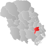
 Holla within Telemark | |
| Coordinates: 59°16′57″N 9°15′56″E / 59.28245°N 9.26547°E | |
| Country | Norway |
| County | Telemark |
| District | Grenland |
| Established | 1 Jan 1838 |
| • Created as | Formannskapsdistrikt |
| Disestablished | 1 Jan 1964 |
| • Succeeded by | Nome Municipality |
| Administrative centre | Ulefoss |
| Area (upon dissolution) | |
| • Total | 252 km2 (97 sq mi) |
| Population (1964) | |
| • Total | 4,352 |
| • Density | 17/km2 (45/sq mi) |
| Demonym | Hollasokning[1] |
| Official language | |
| • Norwegian form | Neutral[2] |
| Time zone | UTC+01:00 (CET) |
| • Summer (DST) | UTC+02:00 (CEST) |
| ISO 3166 code | NO-0819[4] |
Holla is a former municipality in Telemark county, Norway. The 252-square-kilometre (97 sq mi) municipality existed from 1838 until its dissolution in 1964. The area is now part of Nome Municipality. The administrative centre was the village of Ulefoss. The municipality was considered part of the traditional district of Grenland, but in 1964 it became been part of the new Nome municipality which has been considered to be part of the Midt-Telemark district.[5]
- ^ "Navn på steder og personer: Innbyggjarnamn" (in Norwegian). Språkrådet.
- ^ "Norsk Lovtidende. 2den Afdeling. 1932. Samling af Love, Resolutioner m.m". Norsk Lovtidend (in Norwegian). Oslo, Norway: Grøndahl og Søns Boktrykkeri: 453–471. 1932.
- ^ "Forskrift om målvedtak i kommunar og fylkeskommunar" (in Norwegian). Lovdata.no.
- ^ Bolstad, Erik; Thorsnæs, Geir, eds. (26 January 2023). "Kommunenummer". Store norske leksikon (in Norwegian). Kunnskapsforlaget.
- ^ Mæhlum, Lars, ed. (22 January 2023). "Holla (tidligere kommune)". Store norske leksikon (in Norwegian). Kunnskapsforlaget. Retrieved 3 September 2023.