| Holme Moss | |
|---|---|
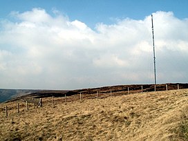
 Holme Moss towards Holme Moss transmitting station | |
| Highest point | |
| Elevation | 524 m (1,719 ft) |
| Coordinates | 53°31′58.87″N 1°51′26.61″W / 53.5330194°N 1.8573917°W |
| Geography | |
Location of Holme Moss in West Yorkshire | |
| Location | Holme Valley, West Yorkshire, England |
| Parent range | Peak District |
| OS grid | SE095040 |
Holme Moss (1,719 feet or 524 metres a.s.l.[1]) is high moorland on the border between the Holme Valley district of Kirklees in West Yorkshire and the High Peak district of Derbyshire in England. Historically on the boundary between the West Riding of Yorkshire and Cheshire, it is just inside the boundary of the Peak District National Park. The A6024 road between Holmfirth and Longdendale crosses the moor near its highest point close to Holme Moss transmitting station's prominent mast.[1]
- ^ a b OL1 Dark Peak Area (Map). 1:25000. Explorer. Ordnance Survey. Archived from the original on 3 March 2016. Retrieved 12 September 2012.
