Holmesville, Ohio | |
|---|---|
 Holmesville Post Office | |
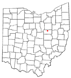
 Location of Holmesville, Ohio | |
 Detailed map of Holmesville | |
| Coordinates: 40°37′44″N 81°55′24″W / 40.62889°N 81.92333°W | |
| Country | United States |
| State | Ohio |
| County | Holmes |
| Township | Prairie |
| Area | |
| • Total | 0.23 sq mi (0.60 km2) |
| • Land | 0.22 sq mi (0.58 km2) |
| • Water | 0.01 sq mi (0.02 km2) |
| Elevation | 850 ft (260 m) |
| Population (2020) | |
| • Total | 371 |
| • Density | 1,663.68/sq mi (643.38/km2) |
| Time zone | UTC-5 (Eastern (EST)) |
| • Summer (DST) | UTC-4 (EDT) |
| ZIP code | 44633 |
| Area code | 330 |
| FIPS code | 39-35994[3] |
| GNIS feature ID | 2398530[2] |
Holmesville is a village in Holmes County, Ohio, United States, along Killbuck Creek. The population was 371 at the 2020 census.
Holmesville was platted in 1836, and named for its location with Holmes County.[4]
- ^ "ArcGIS REST Services Directory". United States Census Bureau. Retrieved September 20, 2022.
- ^ a b U.S. Geological Survey Geographic Names Information System: Holmesville, Ohio
- ^ "U.S. Census website". United States Census Bureau. Retrieved January 31, 2008.
- ^ Overman, William Daniel (1958). Ohio Town Names. Akron, OH: Atlantic Press. p. 62.