You can help expand this article with text translated from the corresponding article in Finnish. (June 2023) Click [show] for important translation instructions.
|
Honkajoki | |
|---|---|
Former municipality | |
| Honkajoen kunta Honkajoki kommun | |
 Honkajoki Church | |
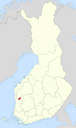
 Location of Honkajoki in Finland | |
| Coordinates: 61°59′35″N 22°15′50″E / 61.99306°N 22.26389°E | |
| Country | |
| Region | Satakunta |
| Sub-region | Pohjois-Satakunta sub-region |
| Charter | 1867 |
| Consolidated | 2021 |
| Area | |
| • Total | 333.13 km2 (128.62 sq mi) |
| • Land | 331.22 km2 (127.88 sq mi) |
| • Water | 1.8 km2 (0.7 sq mi) |
| Population (2020-12-31) | |
| • Total | 1,595 |
| • Density | 20.76/km2 (53.8/sq mi) |
| Population by age | |
| • 0 to 14 | 13.4% |
| • 15 to 64 | 55.4% |
| • 65 or older | 31.2% |
| Population by native language | |
| • Finnish | 96.5% (official) |
| • Swedish | 0.3% |
| • Others | 3.3% |
| Time zone | UTC+02:00 (EET) |
| • Summer (DST) | UTC+03:00 (EEST) |
| Municipal tax rate | 22.50%[3] |
| Climate | Dfc |
| Website | www.honkajoki.fi |
Honkajoki (Finnish: [ˈhoŋkɑˌjoki]; Hongonjoki until 1952)[4] is a former municipality of Finland. It was merged with the town of Kankaanpää on 1 January 2021.
It was located in the province of Western Finland and was part of the Satakunta region. The population of Honkajoki was 1,595 (31 December 2020)[2] and the municipality covered an area of 331.22 km2 (127.88 sq mi) of which 1.8 km2 (0.69 sq mi) was inland water (1 January 2018).[5] The population density was 20.76/km2 (53.8/sq mi).
The municipality was unilingually Finnish.
- ^ "Finland's preliminary population figure was 5,625,011 at the end of August 2024". Population structure. Statistics Finland. 2024-09-24. ISSN 1797-5395. Retrieved 2024-09-25.
- ^ a b "Population according to age (1-year) and sex by area and the regional division of each statistical reference year, 2003-2020". StatFin. Statistics Finland. Retrieved 2 May 2021.[permanent dead link]
- ^ "Luettelo kuntien ja seurakuntien tuloveroprosenteista vuonna 2020" (PDF). Vero.fi (in Finnish). Finnish Tax Administration. Retrieved 2 May 2021.
- ^ "Historia". honkajoenseurakunta.fi (in Finnish). Archived from the original on Jan 24, 2018. Retrieved July 15, 2022.
- ^ "Area of Finnish Municipalities 1.1.2018" (PDF). National Land Survey of Finland. Retrieved 30 January 2018.
