Hornindal Municipality
Hornindal kommune | |
|---|---|
| Hornindalen herred (historic name) | |
 View of the lake Hornindalsvatnet | |
|
| |
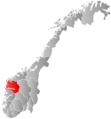
 Sogn og Fjordane within Norway | |
 Hornindal within Sogn og Fjordane | |
| Coordinates: 61°59′55″N 06°35′03″E / 61.99861°N 6.58417°E | |
| Country | Norway |
| County | Sogn og Fjordane |
| District | Nordfjord |
| Established | 1 Jan 1867 |
| • Preceded by | Eid Municipality |
| Disestablished | 1 Jan 1965 |
| • Succeeded by | Stryn Municipality |
| Re-established | 1 Jan 1977 |
| • Preceded by | Stryn Municipality |
| Disestablished | 1 Jan 2020 |
| • Succeeded by | Volda Municipality |
| Administrative centre | Grodås |
| Government | |
| • Mayor (2015-2019) | Stig Olav Lødemel (H) |
| Area (upon dissolution) | |
| • Total | 191.60 km2 (73.98 sq mi) |
| • Land | 178.44 km2 (68.90 sq mi) |
| • Water | 13.16 km2 (5.08 sq mi) 6.9% |
| • Rank | #334 in Norway |
| Population (2018) | |
| • Total | 1,175 |
| • Rank | #381 in Norway |
| • Density | 6.6/km2 (17/sq mi) |
| • Change (10 years) | |
| Demonym | Horndøl[1] |
| Official language | |
| • Norwegian form | Nynorsk |
| Time zone | UTC+01:00 (CET) |
| • Summer (DST) | UTC+02:00 (CEST) |
| ISO 3166 code | NO-1444[3] |
| Website | Official website |
Hornindal is a former municipality in the old Sogn og Fjordane county, Norway. It existed from 1867 until 1965 and then again from 1977 until 2020. It was located in the traditional district of Nordfjord. The administrative centre of the municipality was the village of Grodås. The municipality was located at the eastern end of the lake Hornindalsvatnet, the deepest lake in Northern Europe. The rest of the lake lies inside neighboring Eid Municipality.
The European route E39 highway runs through Hornindal Municipality as it makes its route along the western coast of Norway. The Kviven Tunnel was completed in 2012 as part of the new E39 route connecting Hornindal to Volda Municipality in Møre og Romsdal county to the north. The tunnel was constructed to avoid the ferry crossing over the Voldsfjorden and it shortened the distance from Hornindal to Volda significantly.
At the time of its dissolution in 2020, the 192-square-kilometre (74 sq mi) municipality is the 334th largest by area out of the 422 municipalities in Norway. Hornindal is the 381st most-populous municipality in Norway, with a population of 1,175. The municipality's population density is 6.6 inhabitants per square kilometre (17/sq mi) and its population has decreased by 3% over the last decade.[when?][4][5]
- ^ "Navn på steder og personer: Innbyggjarnamn" (in Norwegian). Språkrådet.
- ^ "Forskrift om målvedtak i kommunar og fylkeskommunar" (in Norwegian). Lovdata.no.
- ^ Bolstad, Erik; Thorsnæs, Geir, eds. (26 January 2023). "Kommunenummer". Store norske leksikon (in Norwegian). Kunnskapsforlaget.
- ^ Statistisk sentralbyrå (2018). "Table: 06913: Population 1 January and population changes during the calendar year (M)" (in Norwegian). Retrieved 29 September 2019.
- ^ Statistisk sentralbyrå. "09280: Area of land and fresh water (km²) (M)" (in Norwegian). Retrieved 29 September 2019.

