| Housatonic Range Trail | |
|---|---|
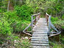
 Footbridge over Morrisey Brook on Housatonic Range Trail, Gaylordsville section of New Milford, Connecticut. | |
| Length | 6.2 mi (10.0 km) |
| Location | New Milford Connecticut |
| Designation | CFPA Blue-Blazed Trail |
| Trailheads | Candlewood Mountain summit 41°34′48″N 73°27′11″W / 41.5801°N 73.4531°W; Gaylordsville Cemetery on Gaylord Road in Gaylordsville, Connecticut 41°37′54″N 73°29′00″W / 41.6316°N 73.4832°W |
| Use | hiking, snowshoeing, fishing, geocaching, other |
| Highest point | Candlewood Mountain summit, 971 ft (296 m) |
| Lowest point | Yellow-dot Spur side trail head on CT-7 near Housatonic River, 350 ft (110 m) |
| Difficulty | easy, with some difficult sections (bypass routes available) |
| Sights | Housatonic River, Candlewood Mountain, Tory's Cave, Kelly's Slide and Cave, "Suicide Ledges", "Corkscrew" |
| Hazards | hunters, deer ticks, poison ivy |
The Housatonic Range Trail is a 6.2-mile (10.0 km) Blue-Blazed hiking trail on Candlewood Mountain in the town of New Milford. The north-south axis of the trail parallels the Housatonic River through private land and land trust (e.g. Weantinoge Heritage Land Trust) parcels. The Housatonic Range Trail is maintained largely through the efforts of the Connecticut Forest and Park Association, which provides online Blue Trail maps.
The Housatonic Range Trail (a.k.a. "HuRT") is primarily used as a through-hike or bird-watching. The trail consists of several quiet woodland segments, with terrain ranging from riparian valley to ridgeline escarpments; it is intersected in a handful of places by small country lanes where car-parking slots are very convenient but of limited size. Thus, the trail is taken as one through-hike, or a series of shorter hikes. The northern end of the trail veers slightly westward away from the Housatonic River.
Notable features include: the only true cave in Connecticut, although it is closed to protect a bat colony; a few modest high points with views of the Housatonic River valley, Candlewood Mountain, Kelly's Slide, Pine Knob, Boardman Mountain and the Straits Rock ridge top. There are several boulder/rock formations (including the "Corkscrew") and stone fences. There is one segment of the trail which is very close to residential areas (Concord Way).