| Huaguruncho | |
|---|---|
| Tarata | |
 | |
| Highest point | |
| Elevation | 5,723 m (18,776 ft) |
| Coordinates | 10°31′52″S 75°55′54″W / 10.53111°S 75.93167°W |
| Geography | |
| Location | Peru, Pasco Region |
| Parent range | Andes, Waqurunchu |
| Climbing | |
| First ascent | 17 August 1956, John Streetly & Mike Westmacott[1] |
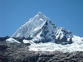
Huaguruncho,[2][3][4][5][6] Tarata[7][8] or Huagaruncho[5][9] is a 5,723-metre-high (18,776 ft)[4][5][8] mountain in the Huaguruncho mountain range in the Andes of Peru. Its highest peak, officially named Tarata,[8] is located in the Pasco Region, Pasco Province, on the border of the districts of Huachón and Ticlacayan. A minor peak, named Huaguruncho Chico[8] by the IGN map, lies west of it in the Ticlacayan District.[7]
Research revealed that fluctuations in Huaguruncho's glaciers were caused by temperature changes in the tropical Atlantic Ocean, with the last major glacial expansion occurring ca. 4000–2000 years ago.[6]
In 1956 John Kempe led an expedition to attempt the first ascent of Huaguruncho.[10] As well as Kempe the party included George Band, Dr. Don Stafford Matthews, John Streetly, Jack Tucker and Mike Westmacott. Streetly and Westmacott successfully reached the summit on 17 August 1956.[1][11]
- ^ a b Band, G. C.; Westmacott, M. H.; Kempe, John (December 1957). "The Exploration of Huagaruncho: A Peruvian Journey". Geographical Journal. #123 (4): ‘437-447. doi:10.2307/1790344. Retrieved 14 September 2024.
- ^ Lezameta, Pablo (2004). Documental de la provincia de Pachitea. Ediciones PASALEAP. pp. 12, 15, 20.
- ^ Box, Ben (1999). The South American Handbook. McGraw-Hill/Contemporary. p. 1380. ISBN 9780844249841.
- ^ a b "Huaguruncho". www.montanasperuanas.com. Archived from the original on 2016-08-20. Retrieved 2016-07-16.
- ^ a b c Biggar, John (2005). The Andes: A Guide for Climbers. Andes. p. 107. ISBN 9780953608720.
Huagaruncho
- ^ a b Stansell, Nathan D.; et al. (2015). "Late Glacial and Holocene glacier fluctuations at Nevado Huaguruncho in the Eastern Cordillera of the Peruvian Andes". Geology. 43 (8): 747–750. doi:10.1130/G36735.1.
- ^ a b escale.minedu.gob.pe - UGEL map of the Pasco Province (Pasco Region)
- ^ a b c d Peru 1:100 000, Ulcumayo (22-l). IGN (Instituto Geográfico Nacional - Perú).
- ^ Neate, Jill (1994). "Peru". Mountaineering in the Andes. RGS-IBG Expedition Advisory Centre. ISBN 0-907649-64-5.
Huagaruncho
- ^ "Huagaruncho". MEF – Mount Everest Foundation. Retrieved 14 September 2024.
- ^ Westmacott, Michael (1958). "Huagaruncho". In Barnes, Malcolm (ed.). Mountain World 1958/59. George Allen and Unwin. pp. 65–75.
