Hurricane, West Virginia | |
|---|---|
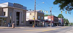
 Main Street in Hurricane in 2007 | |
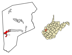
 Location of Hurricane in Putnam County, West Virginia. | |
| Coordinates: 38°25′57″N 82°1′11″W / 38.43250°N 82.01972°W | |
| Country | United States |
| State | West Virginia |
| County | Putnam |
| Government | |
| • Type | Mayor-Council |
| • Mayor | Scott Edwards |
| Area | |
• Total | 3.78 sq mi (9.78 km2) |
| • Land | 3.74 sq mi (9.70 km2) |
| • Water | 0.03 sq mi (0.08 km2) |
| Elevation | 705 ft (215 m) |
| Population | |
• Total | 6,977 |
• Estimate (2021)[2] | 6,919 |
| • Density | 1,717.41/sq mi (663.15/km2) |
| Time zone | UTC-5 (Eastern (EST)) |
| • Summer (DST) | UTC-4 (EDT) |
| ZIP code | 25526 |
| Area code(s) | 304, 681 |
| FIPS code | 54-39532[3] |
| GNIS feature ID | 1554759[4] |
| Website | http://www.hurricanewv.com/ |
Hurricane (/ˈhɜːrʌkɪn/ HUR-uh-kin)[a] is a city in Putnam County, West Virginia, United States. The population was 6,977 at the 2020 census.[2] Located roughly equidistant from Charleston and Huntington, it is part of the Huntington–Ashland metropolitan area.
- ^ "2019 U.S. Gazetteer Files". United States Census Bureau. Retrieved August 7, 2020.
- ^ a b c "City and Town Population Totals: 2020-2021". Census.gov. US Census Bureau. Retrieved July 3, 2022.
- ^ "U.S. Census website". United States Census Bureau. Retrieved January 31, 2008.
- ^ "US Board on Geographic Names". United States Geological Survey. October 25, 2007. Retrieved January 31, 2008.
- ^ Kirk, Sam (January 4, 2022). "West Virginia place names you might be saying wrong". WBOY-TV. Clarksburg, West Virginia. Retrieved April 21, 2023.
Cite error: There are <ref group=lower-alpha> tags or {{efn}} templates on this page, but the references will not show without a {{reflist|group=lower-alpha}} template or {{notelist}} template (see the help page).
