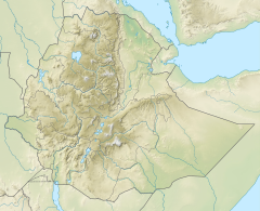
| Ilala | |
|---|---|
 The Ilala River at Romanat | |
Ilala River in Tigray Region | |
| Location | |
| Country | Ethiopia |
| Region | Tigray Region |
| Districts (woreda) | Inderta |
| Physical characteristics | |
| Source | Chichat |
| • location | Dergajen |
| • elevation | 2,376 m (7,795 ft) |
| Mouth | Giba River River |
• location | Qarano in Addi Azmera |
• coordinates | 13°35′28″N 39°22′37″E / 13.591°N 39.377°E |
• elevation | 1,740 m (5,710 ft) |
| Length | 46 km (29 mi) |
| Basin size | 341 km2 (132 sq mi) |
| Width | |
| • average | 25 m (82 ft) |
| Discharge | |
| • location | Confluence to Giba River[1] |
| • maximum | 259 m3/s (9,100 cu ft/s) |
| Basin features | |
| River system | Permanent river |
| Landmarks | Mekelle City |
| Waterbodies | Chichat, Inda Zib'i, Arato |
| Waterfalls | Romanat |
| Bridges | Mekelle, Kwiha |
| Topography | Mountains and deep gorges |
The Ilala is a river of northern Ethiopia. Rising in the mountains of Dergajen (2,676 metres above sea level), it flows westward to Giba River which empties finally in the Tekezé River.[2]

- ^ Amanuel Zenebe, and colleagues (2013). "Spatial and temporal variability of river flows in the degraded semi-arid tropical mountains of northern Ethiopia". Zeitschrift für Geomorphologie. 57 (2): 143–169. doi:10.1127/0372-8854/2012/0080.
- ^ Jacob, M. and colleagues (2019). Geo-trekking map of Dogu'a Tembien (1:50,000). In: Geo-trekking in Ethiopia's Tropical Mountains - The Dogu'a Tembien District. SpringerNature. ISBN 978-3-030-04954-6.
