Indianapolis Regional Airport | |||||||||||||||
|---|---|---|---|---|---|---|---|---|---|---|---|---|---|---|---|
| Summary | |||||||||||||||
| Airport type | Public | ||||||||||||||
| Owner | Indianapolis Airport Authority | ||||||||||||||
| Operator | Jet Access Indianapolis | ||||||||||||||
| Serves | Indianapolis, Indiana | ||||||||||||||
| Location | Greenfield / McCordsville | ||||||||||||||
| Elevation AMSL | 862 ft / 263 m | ||||||||||||||
| Coordinates | 39°50′37″N 085°53′49″W / 39.84361°N 85.89694°W | ||||||||||||||
| Map | |||||||||||||||
 | |||||||||||||||
| Runways | |||||||||||||||
| |||||||||||||||
| Statistics | |||||||||||||||
| |||||||||||||||
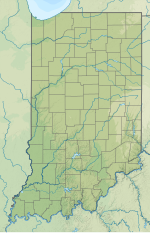
Indianapolis Regional Airport[1][2] (ICAO: KMQJ, FAA LID: MQJ) is a public use airport in Hancock County, Indiana, United States.[1] Owned by Indianapolis Airport Authority, it is 12 nautical miles (22 km) east of the central business district of Indianapolis.[1] The airport is also 7 nautical miles (13 km) northwest of Greenfield[3] and 3 nautical miles (6 km) southwest of McCordsville.[4] It was known as Mount Comfort Airport until March 2011.[2][5]
This facility is included in the National Plan of Integrated Airport Systems for 2017–2021, which categorized it as a general aviation reliever airport[6] for Indianapolis International Airport. Although many U.S. airports use the same three-letter location identifier for the FAA and IATA, Indianapolis Regional Airport is assigned MQJ by the FAA[1] but has no designation from the IATA[7] (which assigned MQJ to Moma Airport in Khonuu, Russia).[8]
- ^ a b c d e FAA Airport Form 5010 for MQJ PDF. Federal Aviation Administration. effective July 13, 2023.
- ^ a b c "Indianapolis Regional Airport". Indianapolis Airport Authority. Archived from the original on August 15, 2010. Retrieved August 8, 2013.
- ^ "Distance and heading from Greenfield to KMQJ". Great Circle Mapper. Retrieved August 8, 2013.
- ^ "Distance and heading from McCordsville to KMQJ". Great Circle Mapper. Retrieved August 8, 2013.
- ^ "Mount Comfort Airport becomes Indianapolis Regional on Friday, March 11, 2011" (PDF) (Press release). Indianapolis Airport Authority. March 9, 2011. Archived from the original (PDF) on July 12, 2012. Retrieved August 8, 2013.
- ^ "Appendix A: List of NPIAS Airports with 5-Year Forecast Activity and Development Cost". National Plan of Integrated Airport Systems (NPIAS) Reports. Federal Aviation Administration. October 4, 2010. Archived from the original on 2012-10-27.
- ^ "Indianapolis Regional (IATA: none, ICAO: KMQJ, FAA: MQJ)". Great Circle Mapper. Retrieved August 8, 2013.
- ^ "IATA Airport Code Search (MQJ – City: Khonuu, Airport: Moma)". International Air Transport Association. Retrieved August 8, 2013.

