| Inkersall Green | |
|---|---|
 Attlee Road, Inkersall | |
Location within Derbyshire | |
| OS grid reference | SK419728 |
| District | |
| Shire county | |
| Region | |
| Country | England |
| Sovereign state | United Kingdom |
| Post town | CHESTERFIELD |
| Postcode district | S43 |
| Dialling code | 01246 |
| Police | Derbyshire |
| Fire | Derbyshire |
| Ambulance | East Midlands |
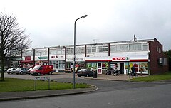
Inkersall and Inkersall Green (informally referred to by local residents as Inky[citation needed]) are areas of settlement in Derbyshire, England. They are located south of the A619 road, 4 miles (6 km) east of Chesterfield and close to Junction 29a of the M1 Motorway.
Inkersall is a town just outside Staveley, which has seen fast development over the last few years. Recent developments include the creation of a small children's park along with the building of an additional convenience shop. Inkersall has two public houses, the Hop Flower and the Double Top.
The village is served by a regular bus service, allowing residents to travel to Staveley, Chesterfield and elsewhere. The Trans Pennine Trail passes alongside the village.
