| Inn Romansh: En | |
|---|---|
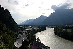
 Lower Inn valley from Rattenberg castle | |
 | |
| Location | |
| Countries | |
| Cities | |
| Physical characteristics | |
| Source | |
| • location | Swiss Alps (Lägh dal Lunghin) |
| • coordinates | 46°25′00″N 9°40′35″E / 46.41673°N 9.67645°E |
| • elevation | 2,484 m (8,150 ft) |
| Mouth | |
• location | Danube (Passau) |
• coordinates | 48°34′25″N 13°28′38″E / 48.57353°N 13.47713°E |
• elevation | 291 m (955 ft) |
| Length | 518.5 km (322.2 mi) [1] |
| Basin size | 26,053 km2 (10,059 sq mi) [1] |
| Discharge | |
| • location | mouth |
| • average | 735 m3/s (26,000 cu ft/s) |
| Basin features | |
| Progression | Danube→ Black Sea |
 | |

The Inn (Latin: Aenus;[2] Romansh: En) is a river in Switzerland, Austria and Germany. The 518 km (322 mi) long river is a right tributary of the Danube, being the third largest tributary of the Danube by discharge. The highest point of its drainage basin is the summit of Piz Bernina at 4,049 m (13,284 ft). The Engadine, the valley of the En, is the only Swiss valley whose waters end up in the Black Sea (via the Danube).
- ^ a b Complete table of the Bavarian Waterbody Register by the Bavarian State Office for the Environment (xls, 10.3 MB)
- ^ Richard J.A. Talbert, ed. (2000). Barrington Atlas of the Greek and Roman World: Map-By-Map Directory. Vol. I. Princeton, NJ and Oxford, UK: Princeton University Press. p. 171. ISBN 0691049459.