Inuvik (Mike Zubko) Airport | |||||||||||
|---|---|---|---|---|---|---|---|---|---|---|---|
 | |||||||||||
| Summary | |||||||||||
| Airport type | Public | ||||||||||
| Operator | Government of the Northwest Territories | ||||||||||
| Location | Inuvik, Northwest Territories | ||||||||||
| Time zone | MST (UTC−07:00) | ||||||||||
| • Summer (DST) | MDT (UTC−06:00) | ||||||||||
| Elevation AMSL | 222 ft / 68 m | ||||||||||
| Coordinates | 68°18′14″N 133°28′59″W / 68.30389°N 133.48306°W | ||||||||||
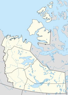
| Map | |||||||||||
 | |||||||||||
| Runways | |||||||||||
| |||||||||||
| Statistics (2010) | |||||||||||
| |||||||||||
Inuvik (Mike Zubko) Airport (IATA: YEV, ICAO: CYEV) is located 6.5 nautical miles (12.0 km; 7.5 mi) east of Inuvik, Northwest Territories, Canada.
The airport is classified as an airport of entry by Nav Canada and is staffed by the Canada Border Services Agency (CBSA). CBSA officers at this airport can handle general aviation aircraft only, with no more than 15 passengers.[1]
It is also used as a forward operating base for CF-18 Hornet military jets operated by the Royal Canadian Air Force.
In 2019, the federal government announced a $150 million funding to extend the runway by an additional 3000 ft to a total length of 9000 ft and modernize the lighting, navigation and military aircraft landing systems at the airport.[4]
In 1995, the airport was named for Mike Zubko (1923–1991), a famous local aviator.[5]
- ^ a b Canada Flight Supplement. Effective 0901Z 16 July 2020 to 0901Z 10 September 2020.
- ^ Synoptic/Metstat Station Information Archived 2013-06-27 at the Wayback Machine
- ^ Total aircraft movements by class of operation — NAV CANADA flight service stations
- ^ "Federal gov't announces more money for Inuvik airport". CBC News. 2019-09-04. Retrieved 2024-07-11.
- ^ Mike Zubko, Honour Roll, 1923-1991

