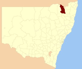
| Inverell Shire New South Wales | |||||||||||||||
|---|---|---|---|---|---|---|---|---|---|---|---|---|---|---|---|
 Location in New South Wales | |||||||||||||||
| Coordinates | 29°46′S 151°07′E / 29.767°S 151.117°E | ||||||||||||||
| Population |
| ||||||||||||||
| • Density | 2.07448/km2 (5.3729/sq mi) | ||||||||||||||
| Established | 1 July 1979 | ||||||||||||||
| Area | 8,606 km2 (3,322.8 sq mi) | ||||||||||||||
| Mayor | Paul Harmon (Unaligned) | ||||||||||||||
| Council seat | Inverell[3] | ||||||||||||||
| Region | North West Slopes | ||||||||||||||
| State electorate(s) | Northern Tablelands | ||||||||||||||
| Federal division(s) | New England | ||||||||||||||
 | |||||||||||||||
| Website | Inverell Shire | ||||||||||||||
| |||||||||||||||
Inverell Shire is a local government area in the North West Slopes region of New South Wales, Australia adjacent to the Macintyre River and the Gwydir Highway.
The mayor of Inverell Shire Council is Cr. Kate Dight, who is unaligned with any political party.
- ^ Australian Bureau of Statistics (28 June 2022). "Inverell (A)". 2021 Census QuickStats. Retrieved 8 December 2017.
- ^ "3218.0 – Regional Population Growth, Australia, 2017–18". Australian Bureau of Statistics. 27 March 2019. Retrieved 27 March 2019. Estimated resident population (ERP) at 30 June 2018.
- ^ "Inverell Shire Council". Division of Local Government. Retrieved 3 December 2006.