Ireland West Airport Aerfort Iarthar Éireann Chnoc Mhuire | |||||||||||
|---|---|---|---|---|---|---|---|---|---|---|---|
 | |||||||||||
 | |||||||||||
| Summary | |||||||||||
| Airport type | Public | ||||||||||
| Owner/Operator | Connacht Airport Development Company Ltd | ||||||||||
| Serves | Connacht, Ireland | ||||||||||
| Location | Charlestown, County Mayo | ||||||||||
| Elevation AMSL | 665 ft / 203 m | ||||||||||
| Coordinates | 53°54′37″N 008°49′07″W / 53.91028°N 8.81861°W | ||||||||||
| Website | irelandwestairport.com | ||||||||||
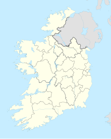
| Map | |||||||||||
 | |||||||||||
| Runways | |||||||||||
| |||||||||||
| Statistics (2023) | |||||||||||
| |||||||||||
Ireland West Airport (IATA: NOC, ICAO: EIKN) (Irish: Aerfort Iarthar Éireann), officially known as Ireland West Airport Knock (Irish: Aerfort Iarthar Éireann Chnoc Mhuire),[3] commonly known as Knock Airport, is an international airport 5.6 km (3.48 mi) south-west of Charlestown, County Mayo, Ireland. The village of Knock is 20 km (12.43 mi) away. 818,000 passengers used the airport in 2023,[4][5] making it the fourth-busiest in Ireland (after Dublin, Cork and Shannon).
- ^ EIKN – IRELAND WEST (PDF). AIP and charts from the Irish Aviation Authority.
- ^ "AVIATION STATISTICS QUARTER 4 AND YEAR 2019". Central Statistics Office. 16 April 2020. Archived from the original on 9 June 2020. Retrieved 11 May 2020.
- ^ Galvin, Clara. "Knock airport defends new 'brand identity'". www.mayonews.ie. Archived from the original on 4 May 2018. Retrieved 3 May 2018.
- ^ "Ireland West Airport reports busiest year on record". Irish Central. 6 January 2024. Archived from the original on 7 January 2024. Retrieved 10 January 2024.
- ^ Smyth, Ronan (5 January 2024). "Ireland West Airport sets record year in 2023". Irish Examiner. Archived from the original on 6 January 2024. Retrieved 10 January 2024.
