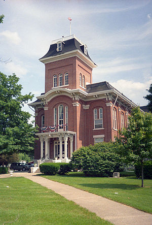
Iroquois County | |
|---|---|
 | |
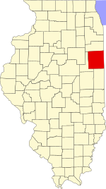
 Location within the U.S. state of Illinois | |
 Illinois's location within the U.S. | |
| Coordinates: 40°44′N 87°49′W / 40.74°N 87.82°W | |
| Country | |
| State | |
| Founded | 1833 |
| Named for | Iroquois River |
| Seat | Watseka |
| Largest city | Watseka |
| Area | |
| • Total | 1,119 sq mi (2,900 km2) |
| • Land | 1,117 sq mi (2,890 km2) |
| • Water | 1.6 sq mi (4 km2) 0.1% |
| Population (2020) | |
| • Total | 27,077 |
| • Estimate (2023) | 26,136
|
| • Density | 24/sq mi (9.3/km2) |
| Time zone | UTC−6 (Central) |
| • Summer (DST) | UTC−5 (CDT) |
| Congressional district | 2nd |
| Website | www |
Iroquois County is a county located in the northeast part of the U.S. state of Illinois. According to the 2020 United States Census, it has a population of 27,077.[1] It is the only county in the United States named Iroquois.[2] The county seat is Watseka.[3] The county is located along the border with Indiana.
- ^ "U.S. Census Bureau QuickFacts: Iroquois County, Illinois".
- ^ Cite error: The named reference
Dowling 1968, p. 9was invoked but never defined (see the help page). - ^ "Find a County". National Association of Counties. Archived from the original on May 31, 2011. Retrieved June 7, 2011.