Island Falls, Maine | |
|---|---|
 | |
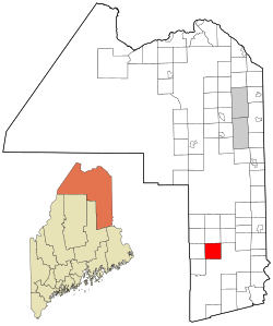
 Location of Island Falls, Maine | |
| Coordinates: 46°0′31″N 68°15′53″W / 46.00861°N 68.26472°W | |
| Country | United States |
| State | Maine |
| County | Aroostook |
| Area | |
| • Total | 40.76 sq mi (105.57 km2) |
| • Land | 36.03 sq mi (93.32 km2) |
| • Water | 4.73 sq mi (12.25 km2) |
| Elevation | 443 ft (135 m) |
| Population (2020) | |
| • Total | 802 |
| • Density | 21/sq mi (8.1/km2) |
| Time zone | UTC-5 (Eastern (EST)) |
| • Summer (DST) | UTC-4 (EDT) |
| ZIP code | 04747 |
| Area code | 207 |
| FIPS code | 23-35065 |
| GNIS feature ID | 0582529 |
| Website | www |
Island Falls is a town in Aroostook County, Maine, United States. The population was 758 at the 2020 census.[2] The primary village of Island Falls in the town is situated at a falls in the West Branch Mattawamkeag River.[3]
- ^ Cite error: The named reference
Gazetteer fileswas invoked but never defined (see the help page). - ^ "Census - Geography Profile: Island Falls town, Aroostook County, Maine". Retrieved January 23, 2022.
- ^ Gannett, Henry (1905). The Origin of Certain Place Names in the United States. Govt. Print. Off. pp. 166.