| Isle Royale National Park | |
|---|---|
 Site of the historic Edisen Fishery | |
| Location | Keweenaw County, Michigan, United States |
| Nearest city | Thunder Bay, Ontario |
| Coordinates | 48°01′N 88°51′W / 48.01°N 88.85°W |
| Area | 571,790 acres (2,314.0 km2)[1] |
| Established | April 3, 1940 |
| Visitors | 28,965 (in 2023)[2] |
| Governing body | National Park Service |
| Website | nps |
Minong | |
 Siskiwit Bay | |
| Area | 189,665 acres (76,755 ha) [133,788 acres (54,142 ha) land and 55,877 acres (22,613 ha) water] |
|---|---|
| NRHP reference No. | 100003341[3] |
| Added to NRHP | January 24, 2019 |
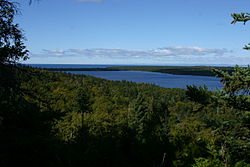
Isle Royale National Park is a national park of the United States consisting of Isle Royale, along with more than 400 small adjacent islands and the surrounding waters of Lake Superior, in Michigan.
Isle Royale is 45 mi (72 km) long and 9 mi (14 km) wide, with an area of 206.73 sq mi (535.4 km2), making it the fourth-largest lake island in the world. In addition, it is the largest natural island in Lake Superior, the second-largest island in the Great Lakes (after Manitoulin Island), the third-largest in the contiguous United States (after Long Island and Padre Island), and the 33rd-largest island in the United States.[4]
Isle Royale National Park was established on April 3, 1940, then additionally protected from development by wilderness area designation in 1976, declared a UNESCO International Biosphere Reserve in 1980, and added to the National Register of Historic Places in 2019 as the Minong Traditional Cultural Property. The park covers 894 sq mi (2,320 km2), with 209 sq mi (540 km2) of land and 685 sq mi (1,770 km2) of surrounding waters.
The park's northern boundary lies adjacent to the Canadian Lake Superior National Marine Conservation Area along the international border. With 25,894 visits in 2021, it is the seventh least-visited National Park in the United States.[5]
- ^ "Listing of acreage – December 31, 2011" (XLSX). Land Resource Division, National Park Service. Retrieved March 7, 2012. (National Park Service Acreage Reports)
- ^ "NPS Annual Recreation Visits Report". National Park Service. Retrieved April 11, 2024.
- ^ "Weekly list 20190201 (aggregate list)". National Park Service. February 1, 2019. Archived from the original on February 2, 2019. Retrieved February 22, 2019.
- ^ "Islands of The World". World Atlas. Archived from the original on June 3, 2019. Retrieved February 22, 2019.
- ^ "Statistical Abstract 2021". National Park Service.

