Issaquena County | |
|---|---|
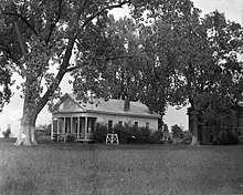
 Historic photo of the Issaquena County Courthouse in Mayersville, Mississippi | |
 Location within the U.S. state of Mississippi | |
 Mississippi's location within the U.S. | |
| Coordinates: 32°44′N 90°59′W / 32.74°N 90.99°W | |
| Country | |
| State | |
| Founded | January 23, 1844 |
| Seat | Mayersville |
| Largest town | Mayersville |
| Area | |
| • Total | 441 sq mi (1,140 km2) |
| • Land | 413 sq mi (1,070 km2) |
| • Water | 28 sq mi (70 km2) 6.4% |
| Population (2020) | |
| • Total | 1,338 |
| • Estimate (2022) | 1,273 |
| • Density | 3.0/sq mi (1.2/km2) |
| Time zone | UTC−6 (Central) |
| • Summer (DST) | UTC−5 (CDT) |
| Congressional district | 2nd |
Issaquena County (/ˌɪsəˈkwiːnə/, ISS-ə-KWEEN-ə) is a county located in the U.S. state of Mississippi. As of the 2020 Census, its population was 1,338,[1] making it the least populous county in the United States east of the Mississippi River. Its county seat is Mayersville.[2] With a per-capita income of $24,489, Issaquena County is, by that measure, the third-poorest county in the United States and the lowest without a prison depleting the numbers.[3]
Issaquena County is located in the Mississippi Delta region. The Mississippi River flows along the entire western boundary of the county, and many of the earliest communities were river ports.
The county's economy is chiefly based on agriculture, though a number of hunting camps are also located here and contribute to the economy. Mississippi's two most recent records for the heaviest alligator taken by a hunter have both been in Issaquena County, the latest in 2012 when a 697.5 lb (316.4 kg) alligator was killed at a camp near Fitler.[4]
- ^ "State & County QuickFacts". United States Census Bureau. Retrieved January 14, 2024.
- ^ "Find a County". National Association of Counties. Archived from the original on May 31, 2011. Retrieved June 7, 2011.
- ^ "Personal Income by County and Metropolitan Area, 2022" (PDF). Bureau of Economic Analysis. November 16, 2023.
- ^ "New Record Gator Bagged in Mississippi". KNOE.COM. September 25, 2012. Archived from the original on February 1, 2014.