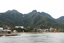
Native name: 厳島 Nickname: Miyajima | |
|---|---|
 Itsukushima Island | |
| Geography | |
| Location | Seto Inland Sea |
| Coordinates | 34°16′32″N 132°18′28″E / 34.27556°N 132.30778°E |
| Area | 30.39 km2 (11.73 sq mi) |
| Highest elevation | 535 m (1755 ft) |
| Highest point | Mount Misen |
| Administration | |
Japan | |
| Demographics | |
| Population | 2000 |


Itsukushima (厳島) is an island in the western part of the Inland Sea of Japan, located in the northwest of Hiroshima Bay. It is popularly known as Miyajima (宮島), which in Japanese means "Shrine Island".[1] The island is one of Hayashi Gahō's Three Views of Japan specified in 1643.[2] Itsukushima is part of the city of Hatsukaichi in Hiroshima Prefecture. The island was part of the former town of Miyajima before the 2005 merger with Hatsukaichi.[3]
Itsukushima is famous for the Itsukushima Shrine, a UNESCO World Heritage Site.[4] The shrine was considered a sacred site for a long time, it is possible that locals built a simple shrine on the site before the complex was built in 593 AD. In 1168 AD, Taira no kiyomori, a warrior-courtier, greatly contributed to giving the shrine its current form. In the 16th century, Toyotomi Hideyoshi, a famed Japanese warlord and shogun, built a large building, the Senjō-kaku, on a hill above the shrine.[5]
Itsukushima has a number of temples, including Toyokuni Shrine with a five-storied pagoda,[6] and Daiganji Temple - one of the three most famous Benzaiten temples of Japan.[7] The island is also famous for its upper hill side cherry blossoms and maple leaf autumn foliage.[8]
The island of Itsukushima, including the waters around it (part of Seto Inland Sea), lies within Setonaikai National Park. This sea is affected by strong tides. At low tide, the bottom of the sea is exposed past the island's torii. At high tide, the sea covers all the previously exposed seabed mud and fills areas underneath the shrine boardwalk.
- ^ Miyajama
- ^ "Three Views of Japan - Topics - Japan Travel". JapanTravel. Retrieved 2024-11-14.
- ^ "宮島歴史略年表|歴史|一般社団法人宮島観光協会". www.miyajima.or.jp. Retrieved 2024-11-14.
- ^ Itsukushima Shinto Shrine UNESCO
- ^ Cartwright, Mark. "Itsukushima Shrine". World History Encyclopedia. Retrieved 2024-11-14.
- ^ "Toyokuni Shrine (Senjokaku) / Goju-no-to". Archived from the original on 2020-03-05. Retrieved 2014-08-28.
- ^ "Daiganji Kikyozan Hokoin (Buddhist temple)". Archived from the original on 2020-03-05. Retrieved 2014-08-28.
- ^ "Miyajama Cherry Blossoms and Fall Foliage" (PDF). Archived from the original (PDF) on 2016-03-03. Retrieved 2014-08-28.

