Itta Bena, Mississippi | |
|---|---|
 Home in the Woods | |
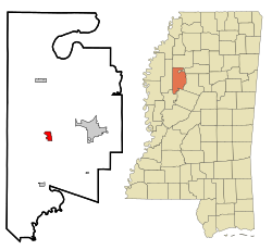
 Location of Itta Bena, Mississippi | |
| Coordinates: 33°29′45″N 90°19′20″W / 33.49583°N 90.32222°W | |
| Country | |
| State | |
| County | Leflore |
| Government | |
| • Mayor | Reginald Freeman |
| Area | |
| • Total | 1.46 sq mi (3.77 km2) |
| • Land | 1.41 sq mi (3.65 km2) |
| • Water | 0.04 sq mi (0.12 km2) |
| Elevation | 131 ft (40 m) |
| Population (2020) | |
| • Total | 1,679 |
| • Density | 1,189.94/sq mi (459.48/km2) |
| Time zone | UTC−6 (Central (CST)) |
| • Summer (DST) | UTC−5 (CDT) |
| ZIP code | 38941 |
| Area code | 662 |
| FIPS code | 28-35260 |
| GNIS feature ID | 0671749 |
| Website | ittabenams |
Itta Bena is a city in Leflore County, Mississippi, United States. The population was 2,049 at the 2010 census. The town's name is derived from the Choctaw phrase iti bina, meaning "forest camp".[2] Itta Bena is part of the Greenwood, Mississippi micropolitan area. It developed as a trading center of an area of cotton plantations.
- ^ "2020 U.S. Gazetteer Files". United States Census Bureau. Retrieved July 24, 2022.
- ^ Baca, Keith A. (2007). Native American place names in Mississippi. University Press of Mississippi. ISBN 978-1-57806-954-5. (available at Google books)
