| Janjira State जंजीरा रियासत | |||||||
|---|---|---|---|---|---|---|---|
| Princely State of British India In union with Jafrabad (1759–1948) | |||||||
| 1489–1948 | |||||||
|
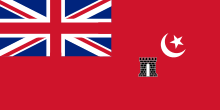
Flag | |||||||
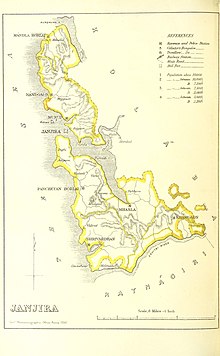
 Janjira State, 1896 | |||||||
| Area | |||||||
• 1931 | 839 km2 (324 sq mi) | ||||||
| Population | |||||||
• 1931 | 110,389 | ||||||
| History | |||||||
• Established | 1489 | ||||||
| 1948 | |||||||
| |||||||
| Today part of | Maharashtra, India | ||||||


Janjira State was a princely state in India during the British Raj.[1] It was governed by the Siddi Khan dynasty of Habesha descent[1] and the state was under the suzerainty of the Bombay Presidency.
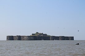
Janjira State was located on the Konkan coast in the present-day Raigad district of Maharashtra. The state included the towns of Murud and Shrivardhan, as well as the fortified island of Murud-Janjira, just off the coastal village of Murud, which was the capital and the residence of the rulers. The state had an area of 839 km2, not counting Jafarabad, and a population of 110,389 inhabitants in 1931. Jafarabad State (also spelled Jafrabad) was a dependency of the Nawab of Janjira State, and located 320 km to its north-northwest.
- ^ a b Chisholm, Hugh, ed. (1911). . Encyclopædia Britannica. Vol. 15 (11th ed.). Cambridge University Press. p. 152.
