Jaren | |
|---|---|
Village | |
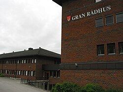
 View of the municipal building in Jaren | |
| Coordinates: 60°23′33″N 10°33′42″E / 60.39257°N 10.56176°E | |
| Country | Norway |
| Region | Eastern Norway |
| County | Innlandet |
| District | Hadeland |
| Municipality | Gran Municipality |
| Area | |
| • Total | 5.52 km2 (2.13 sq mi) |
| Elevation | 225 m (738 ft) |
| Population (2021)[1] | |
| • Total | 4,848 |
| • Density | 878/km2 (2,270/sq mi) |
| Time zone | UTC+01:00 (CET) |
| • Summer (DST) | UTC+02:00 (CEST) |
| Post Code | 2770 Jaren |
Jaren is the administrative centre of Gran Municipality in Innlandet county, Norway. The village is located about 55 kilometres (34 mi) to the northwest of the capital city of Oslo. The lake Randsfjorden (Norway's fourth largest lake) lies about 7 kilometres (4.3 mi) west of Jaren. The village of Brandbu lies about 3 kilometres (1.9 mi) to the northwest and the villages of Ringstad and Gran lie about 4 kilometres (2.5 mi) to the southeast.[3]
Jaren and its neighboring village of Brandbu have grown together through conurbation and Statistics Norway has considered them as one, single urban settlement for many years. The 5.52-square-kilometre (1,360-acre) village of Brandbu/Jaren has a population (2021) of 4,848 and a population density of 878 inhabitants per square kilometre (2,270/sq mi).[1]
The Norwegian National Road 4 and the Gjøvikbanen railway line both run through the village, with the train stopping at Jaren Station. Moen Church lies in the northern part of Jaren.[3]
Jaren is the municipality's industrial center. The cornerstone company Hapro produces industrial electronics. Jaren also has an aluminum goods factory, a quarry, and a grain silo. The Hadeland energy plant is located at Jaren. The Hadeland Folkemuseum has a site located just west of Jaren. The museum includes the Old Tingelstad Church which was built in Romanesque style during the Middle Ages, and it has a well-preserved Renaissance interior.[3]
- ^ a b c Statistisk sentralbyrå (1 January 2021). "Urban settlements. Population and area, by municipality".
- ^ "Jaren, Gran". yr.no. Retrieved 16 October 2022.
- ^ a b c Thorsnæs, Geir, ed. (7 November 2021). "Jaren". Store norske leksikon (in Norwegian). Kunnskapsforlaget. Retrieved 16 October 2022.

