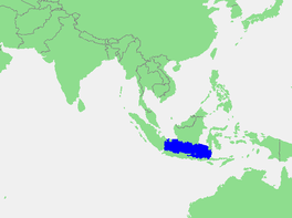
| Java Sea | |
|---|---|
 Location of the Java Sea | |
| Location | Sunda Shelf |
| Coordinates | 5°S 110°E / 5°S 110°E |
| Type | Sea |
| Primary inflows | Barito, Bengawan Solo, Brantas, Ciliwung, Cimanuk, Citarum, Kahayan, Musi, Sampit River |
| Basin countries | Indonesia |
| Max. length | 1,600 km (990 mi) |
| Max. width | 380 km (240 mi) |
| Surface area | 320,000 km2 (120,000 sq mi) |
| Average depth | 46 m (151 ft) |
| Settlements | Batulicin, Cirebon, Jakarta, Jepara, Makassar, Pekalongan, Probolinggo, Semarang, Surabaya, Tanjung Pandan, Tegal, Toboali, Tuban |
The Java Sea (Indonesian: Laut Jawa, Javanese: Segara Jawa) is an extensive shallow sea on the Sunda Shelf, between the Indonesian islands of Borneo to the north, Java to the south, Sumatra to the west, and Sulawesi to the east. Karimata Strait to its northwest links it to the South China Sea. It is a part of the western Pacific Ocean.[1][2]
