Jeff Davis County | |
|---|---|
County | |
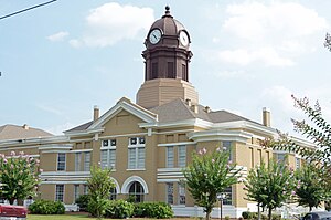
 County courthouse | |
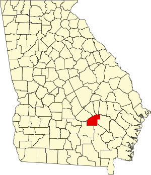
 Location within the U.S. state of Georgia | |
 Georgia's location within the U.S. | |
| Coordinates: 31°48′N 82°38′W / 31.8°N 82.64°W | |
| Country | |
| State | |
| Founded | August 18, 1905 |
| Named for | Jefferson Davis |
| Seat | Hazlehurst |
| Largest city | Hazlehurst |
| Area | |
• Total | 335 sq mi (870 km2) |
| • Land | 331 sq mi (860 km2) |
| • Water | 4.7 sq mi (12 km2) 1.4% |
| Population (2020) | |
• Total | 14,779 |
| • Density | 45/sq mi (17/km2) |
| Time zone | UTC−5 (Eastern) |
| • Summer (DST) | UTC−4 (EDT) |
| Congressional district | 12th |
| Website | jeffdaviscountyga.gov |
Jeff Davis County is a county located in the southeastern part of the U.S. state of Georgia. As of the 2020 census, the population was 14,779.[1] The county seat is Hazlehurst.[2] The county was created on August 18, 1905, and named for Jefferson Davis, the only Confederate president.[3]
- ^ "Census - Geography Profile: Jeff Davis County, Georgia". United States Census Bureau. Retrieved December 27, 2022.
- ^ "Find a County". National Association of Counties. Archived from the original on May 31, 2011. Retrieved June 7, 2011.
- ^ Krakow, Kenneth K. (1975). Georgia Place-Names: Their History and Origins (PDF). Macon, GA: Winship Press. p. 119. ISBN 0-915430-00-2. Archived (PDF) from the original on September 17, 2003.

