Nickname: Sammudo, Samdado ("Island of Three Lacks and Three Abundances") | |
|---|---|
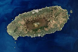
 Satellite image of Jeju Island | |
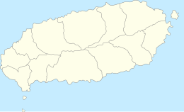
 Map of Jeju Island | |
| Geography | |
| Location | East Asia |
| Coordinates | 33°23′N 126°32′E / 33.38°N 126.53°E |
| Archipelago | Jeju |
| Area | 1,826[1] km2 (705 sq mi) |
| Length | 73 km (45.4 mi) |
| Width | 31 km (19.3 mi) |
| Highest elevation | 1,950 m (6400 ft) |
| Highest point | Hallasan |
| Administration | |
South Korea | |
| Largest settlement | Jeju City (pop. 501,791) |
| Demographics | |
| Population | 678,324 (October 2022) |
| Pop. density | 316/km2 (818/sq mi) |
| Languages | Jeju, Korean |
| Ethnic groups | Jejuans, Korean |
| Korean name | |
| Hangul | 제주도 |
| Hanja | 濟州島 |
| Revised Romanization | Jejudo |
| McCune–Reischauer | Chejudo |
Jeju Island (Jeju/Korean: 제주도; Hanja: 濟州島; RR: Jejudo; IPA: [tɕeːdʑudo]) is South Korea's largest island, covering an area of 1,833.2 km2 (707.8 sq mi), which is 1.83% of the total area of the country.[2] Alongside outlying islands, it is part of Jeju Province and makes up the majority of the province.
The island lies in the Korea Strait, south of the Korean Peninsula, and South Jeolla Province. It is located 82.8 km (51.4 mi) off the nearest point on the peninsula.[3] Jeju is one of two special self-governing provinces in South Korea, meaning that the province is run by local politicians. The Jeju people are indigenous to the island, and it has been populated by modern humans since the early Neolithic period. The Jeju language is considered critically endangered by UNESCO. It is also one of the regions of Korea where Shamanism is most intact.[4]
Jeju Island has an oval shape of 73 km (45 mi) east–west and 31 km (19 mi) north–south, with a gentle slope around Hallasan Mountain in the center. The length of the main road is 181 km (112 mi) and the coastline is 258 km (160 mi). On the northern end of Jeju Island is Gimnyeong Beach, on the southern end Songak Mountain, the western end Suwol Peak, and the eastern end Seongsan Ilchulbong.
The island was formed by the eruption of an underwater volcano approximately 2 million years ago.[5] It contains a natural World Heritage Site, the Jeju Volcanic Island and Lava Tubes.[6] Jeju Island has a subtropical climate; even in winter, the temperature rarely falls below 0 °C (32 °F). Jeju is a popular holiday destination and a sizable portion of the economy relies on tourism and related economic activity.
- ^ "Joshua Calder's World Island Info - Largest Islands of Selected Countries". Worldislandinfo.com. Retrieved 30 January 2016.
- ^ Woo, Kyung Sik; Sohn, Young Kwan; Yoon, Seok Hoon; Ahn, Ung San; Spate, Andy (1 July 2013). Jeju Island Geopark - A Volcanic Wonder of Korea. Springer Science & Business Media. ISBN 978-3-642-20564-4.
- ^ Landsat/Copernicus; Data SIO; NOAA; United States Navy; NGA; GEBCO; TMap Mobility; TerraMetrics (2022). "Korea Strait" (Map). Google Earth. Alphabet. Retrieved 15 May 2022.
- ^ Choi, Joon-sik (2006). Folk-Religion: The Customs in Korea. Ewha Womans University Press. Ewha Womans University Press. ISBN 978-8973006281.
- ^ "Jeju Island". Business Traveller. February 2011.
- ^ "Unesco names World Heritage sites". BBC News. 28 June 2007. Retrieved 6 May 2010.
