Jennings, Missouri | |
|---|---|
| City of Jennings | |
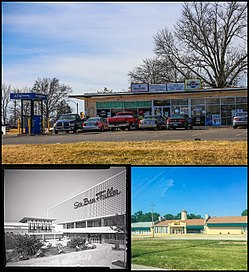
 Top: Business in Jennings; bottom left: River Roads Mall (demolished); bottom right: Church in Jennings | |
 Location of Jennings, Missouri | |
| Coordinates: 38°43′23″N 90°15′52″W / 38.72306°N 90.26444°W | |
| Country | United States |
| State | Missouri |
| County | St. Louis |
| Area | |
| • Total | 3.73 sq mi (9.67 km2) |
| • Land | 3.73 sq mi (9.67 km2) |
| • Water | 0.00 sq mi (0.00 km2) |
| Elevation | 522 ft (159 m) |
| Population (2020) | |
| • Total | 12,895 |
| • Density | 3,454.33/sq mi (1,333.67/km2) |
| Time zone | UTC-6 (Central (CST)) |
| • Summer (DST) | UTC-5 (CDT) |
| ZIP code | 63136 |
| Area code | 314 |
| FIPS code | 29-37178[3] |
| GNIS feature ID | 2395465[2] |
| Website | Official website |
Jennings is a city in St. Louis County, Missouri, United States. Per the 2020 census, the population was 12,895.[4]
- ^ "ArcGIS REST Services Directory". United States Census Bureau. Retrieved August 28, 2022.
- ^ a b U.S. Geological Survey Geographic Names Information System: Jennings, Missouri
- ^ "U.S. Census website". United States Census Bureau. Retrieved January 31, 2008.
- ^ "Jennings city, Missouri". United States Census Bureau. Retrieved April 15, 2022.
