This article needs additional citations for verification. (June 2021) |
| Jura Mountains | |
|---|---|
 View towards Lélex from near the Crêt de la Neige | |
| Highest point | |
| Peak | Crêt de la Neige |
| Elevation | 1,720 m (5,640 ft) |
| Coordinates | 46°16′15″N 5°56′22″E / 46.27083°N 5.93944°E |
| Geography | |
| Countries | |
| Regions/Cantons | |
| Range coordinates | 46°40′N 6°15′E / 46.667°N 6.250°E |
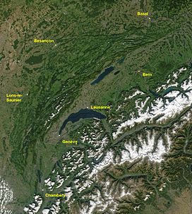
The Jura Mountains (/ˈdʒʊərə, ˈʒʊərə/ JOOR-ə, ZHOOR-ə)[1] are a sub-alpine mountain range a short distance north of the Western Alps and mainly demarcate a long part of the French–Swiss border. While the Jura range proper ("folded Jura", Faltenjura) is located in France and Switzerland, the range continues northeastwards through northern Switzerland and Germany as the Table Jura ("not folded Jura", Tafeljura), which is crossed by the High Rhine.
