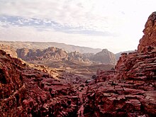
Kadesh or Qadesh or Cades (Biblical Hebrew: קָדֵשׁ, from the root קדש "holy"[1]) is a place-name that occurs several times in the Hebrew Bible, describing a site or sites located south of, or at the southern border of, Canaan and the Kingdom of Judah in the kingdom of Israel. Many modern academics hold that it was a single site, located at the modern Tel el-Qudeirat, while some academics and rabbinical authorities hold that there were two locations named Kadesh. A related term, either synonymous with Kadesh or referring to one of the two sites, is Kadesh (or Qadesh) Barnea. Various etymologies for Barnea have been proposed, including 'desert of wanderings,' but none have produced widespread agreement.[2][3]
The Bible mentions Kadesh and/or Kadesh Barnea in a number of episodes, making it an important site (or sites) in narratives concerning Israelite origins. Kadesh was the chief site of encampment for the Israelites during their wandering in the Zin Desert (Deuteronomy 1:46), as well as the place from which the Israelite spies were sent to Canaan (Numbers 13:1–26). The first failed attempt to capture Canaan was made from Kadesh (Numbers 14:40–45). Moses struck a rock (rather than speaking to it as the Lord commanded) that brought forth water at Kadesh (Numbers 20:11). Miriam (Numbers 20:1) and Aaron (Numbers 20:22–29) both died and were buried near a place named Kadesh. Moses sent envoys to the King of Edom from Kadesh (Numbers 20:14), asking for permission to let the Israelites use the King's Highway passing through his territory, which the Edomite king denied.
Kadesh Barnea is a key feature in the common biblical formula delineating the southern border of the Land of Israel (cf. Numbers 34:4, Joshua 15:3, Ezekiel 47:19 etc.)[4] and thus its identification is key to understanding both the ideal and geopolitically realised borders of ancient Israel.

- ^ Brown, Francis, S. R. Driver, and Charles A. Briggs, eds. (1907). A Hebrew and English Lexicon of the Old Testament. New York: Houghton Mifflin. pp. 871–874; Koeler-Baumgartner 3:1072–1078; TDOT 12:521–545.
- ^ Trumbull, Henry Clay (1884). Kadesh-Barnea: Its Importance and Probable Site. New York: Charles Scribner's Sons. pp. 24–25. Retrieved 8 March 2021.
- ^ Kadesh Barnea (קדש ברנע), whence the spies were sent to search out the Land of Canaan, near Canaan's southern border, is identified by Eusebius (Onomasticon) and by Jacob Sussmann as being Petra in Arabia, the southernmost extent of the boundary of Israel in the 4th century BCE (See: Jacob Sussmann, "The Boundaries of Eretz-Israel", Tarbiẕ (Academic Journal), pub. by: Mandel Institute for Jewish Studies, Jerusalem 1976, p. 239). Cf. Josephus, Antiquities of the Jews (iv.vii.§1) who names five Midianite kings who formerly governed the region, but by the 1st century CE the place had already come under the possession of the Arabs: "Of these there were five: Ochus and Sures, Robees and Ures, and, the fifth, Rekem; the city which bears his name ranks highest in the land of the Arabs and to this day is called by the whole Arabian nation, after the name of its royal founder, Rekeme: it is the Petra of the Greeks" (Loeb Classical Library). Others have identified Kadesh Barnea, not with Petra, but with Ein el Qudeirāt, or what is also called Tell Qudeirāt near Quseimah in the region of the central Negev, now belonging to Egypt (Ben-David Ben-Gad Hacohen, 1998, pp. 28–29), arguing that Reḳam (Petra) in Mishnah Gittin was not considered the Land of Israel, while Reḳam of Ǧayāh is listed as a frontier city of the Land of Israel. (See also Y. Aharoni, "Kadesh-barnea," Encyclopaedia Biblica, 7:39–42; R. Cohen, "Kadesh-Barnea," New Encyclopedia of Archaeological Excavation 3:843–847).
- ^ Zecharia Kallai, "The Southern Border of the Land of Israel — Pattern and Application", Vetus Testamentum XXXVII 4 1987, 438–445.