| Kalamita Bay | |
|---|---|
 | |
| Location | Black Sea |
| Coordinates | 45°03′00″N 33°28′00″E / 45.05000°N 33.46667°E |
| Ocean/sea sources | Atlantic Ocean |
| Basin countries | Russia/Ukraine |
| Max. length | 13 km (8.1 mi) |
| Max. width | 41 km (25 mi) |
| Average depth | 30 m (98 ft) |
| Salinity | ' |
 | |
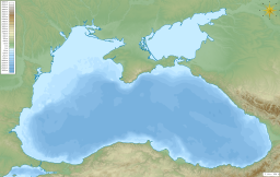
Kalamita Bay (Russian: Каламитский залив, Ukrainian: Каламітська затока, Crimean Tatar: Kalamita körfezi, Каламита корьфези), also known as Gulf of Kalamita, is a bay and a gulf in the Black Sea south of Yevpatoria, Crimea.[1] Kalamita was likewise a name used for Inkerman.
For a 24 km arch east from Cape Karantinny approximately following a geological fault, Yevpatoria Bay forms an arm of Kalamita Bay with a change of current direction from the main bay.[2]
- ^ Каламитский залив Archived 16 April 2014 at the Wayback Machine // Great Soviet Encyclopedia
- ^ Kutaisov, Vadim A.; Smekalova, Tat’jana N. (28 February 2022). "Coastal geoarchaeology of Kerkinitis". Méditerranée. 2016 (126): 18–24. doi:10.35595/2414-9179-2022-2-28-431-446. ISSN 1760-8538. Retrieved 26 December 2023.

