| Kaldygaity Қалдығайты | |
|---|---|
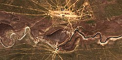
 The Kaldygaity meandering westwards south of Ushana village Sentinel-2 image | |
| Location | |
| Countries | Kazakhstan |
| Physical characteristics | |
| Source | Mt Almastau |
| • coordinates | 50°09′14″N 54°21′07″E / 50.15389°N 54.35194°E |
| • elevation | ca 200 m (660 ft) |
| Mouth | lakes near Tolen |
• coordinates | 49°26′07″N 52°42′00″E / 49.43528°N 52.70000°E |
• elevation | 8 m (26 ft) |
| Length | 243 km (151 mi) |
| Basin size | 5,800 km2 (2,200 sq mi) |
The Kaldygaity (Kazakh: Қалдығайты; Russian: Калдыгайты) is a river in the West Kazakhstan Region, Kazakhstan. It is 243 kilometres (151 mi) long and has a catchment area of 5,800 square kilometres (2,200 sq mi).[1]
The Kaldygaity belongs to the Ural basin. The banks of the river are a seasonal grazing ground for local cattle.[2]
- ^ Cite error: The named reference
KEwas invoked but never defined (see the help page). - ^ Determination of the Degradation Degree of Pasture Lands in the West Kazakhstan Region Based on Monitoring Using Geoinformation Technologies
