You can help expand this article with text translated from the corresponding article in Russian. (September 2022) Click [show] for important translation instructions.
|
Kamianka-Dniprovska
Кам'янка-Дніпровська | |
|---|---|
 Church of Nativity of the Theotokos | |
| Coordinates: 47°27′46″N 34°24′22″E / 47.46278°N 34.40611°E | |
| Country | |
| Oblast | Zaporizhzhia Oblast |
| Raion | Vasylivka Raion |
| Hromada | Kamianka-Dniprovska urban hromada |
| Founded | 1786 |
| Area | |
| • Total | 21 km2 (8 sq mi) |
| Population (2022) | |
| • Total | 12,117 |
| Postal code | 71300 |
| Area code | +380 6138 |
| Climate | Dfa |
 | |
Kamianka-Dniprovska (Ukrainian: Кам'янка-Дніпровська, IPA: [ˈkɑmjɐnkɐ d⁽ʲ⁾n⁽ʲ⁾iˈprɔu̯sʲkɐ]) is a city in Zaporizhzhia Oblast, Ukraine. It served as the administrative center of the former Kamianka-Dniprovska Raion until that raion was merged into Vasylivka Raion in 2020. Population: 12,117 (2022 estimate).[1]
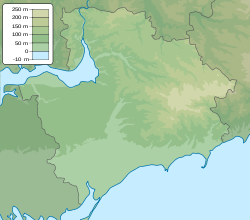
It is located on the south bank of a west-flowing part of the Dnieper River. On the north bank is the town of Nikopol. About 15 kilometres (9.3 mi) east is the power plant at Enerhodar. The river valley was submerged as part of the Kakhovka Reservoir until 2023. The landscape of the area is flat and steppe-like.[citation needed]
The city is home to the Kamianka-Dniprovska District Historical and Archeological Museum.[2]
- ^ Чисельність наявного населення України на 1 січня 2022 [Number of Present Population of Ukraine, as of January 1, 2022] (PDF) (in Ukrainian and English). Kyiv: State Statistics Service of Ukraine. Archived (PDF) from the original on 4 July 2022.
- ^ "Музейний простір. Музеї України та світу".


