This article needs additional citations for verification. (March 2019) |
Kandukur | |
|---|---|
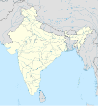
 Dynamic map | |
| Coordinates: 15°13′00″N 79°54′15″E / 15.2166650°N 79.9042°E | |
| Country | India |
| State | Andhra Pradesh |
| District | SPSR Nellore |
| Government | |
| • Type | Municipal Council |
| • Body | Kandukuru Municipal Council |
| • Chairman | Vacant |
| • Deputy Chairman | Vacant |
| • MLA | Inturi Nageswar Rao (TDP) |
| • MP | [[Vemireddy Prabakar reddy]{TDP}]] |
| Area | |
| • Total | 33.06 km2 (12.76 sq mi) |
| Population (2011)[2] | |
| • Total | 57,246 |
| • Rank | 26th (Towns in AP) |
| • Density | 1,700/km2 (4,500/sq mi) |
| Time zone | UTC+5:30 (IST) |
| PIN | |
Kandukur or Kandukuru is a town in SPSR Nellore district of the Indian state of Andhra Pradesh. It is a municipality and the headquarters of Kandukur mandal as well as Kandukur revenue division.[4] Kandukur Mandal is located at the south-east side of the Prakasam District having geographical area around 225 km2.There is only 1 city in the Kandukur Mandal, which is Kandukur Municipality having an area of 37.63 km2.
- ^ "Municipalities, Municipal Corporations & UDAs" (PDF). Directorate of Town and Country Planning. Government of Andhra Pradesh. Archived from the original (PDF) on 28 January 2016. Retrieved 29 January 2016.
- ^ "Census 2011". The Registrar General & Census Commissioner, India. Archived from the original on 12 August 2014. Retrieved 12 August 2014.
- ^ "Elevation for Kandukuru, Nellore district". Veloroutes. Retrieved 12 August 2014.
- ^ "Prakasam District Mandals" (PDF). Census of India. pp. 166, 180. Retrieved 19 January 2015.

