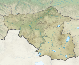
| Kartsakhi Lake | |
|---|---|
 View of the lake from the Georgian side | |
| Coordinates | 41°12′54″N 43°13′16″E / 41.21500°N 43.22111°E |
| Catchment area | 158 km2 (61 sq mi) |
| Basin countries | Georgia, Turkey |
| Surface area | 26.3 km2 (10.2 sq mi) |
| Max. depth | 1 m (3 ft 3 in) |
| Water volume | 19.3 km3 (4.6 cu mi) |
| Salinity | 880 ‰ |
| Surface elevation | 1,800 m (5,900 ft) |
 | |
Kartsakhi Lake (Georgian: კარწახის ტბა, karts'akhis tba), or Lake Khozapini (Georgian: ხოზაფინის ტბა, khozap'inis tba; Turkish: Hazapin Gölü), or Lake Aktaş (Turkish: Aktaş Gölü), is a soda lake in the Caucasus Mountains. It straddles the international border between Georgia (53%) and Turkey (47%). The village of Kartsakhi lies near the lake's northeastern shore.
It is the second largest lake in Georgia, covering an area of 26.3 or 26.6 square kilometers at an altitude of 1799 m.[1][2] It is fed by a number of creeks. During the rainy season, its excess water discharges into the Kura River.[3]
- ^ Hlavinek, Petr (2008). Dangerous pollutants (xenobiotics) in urban waters cycle. Springer. p. 37. ISBN 978-1-4020-6800-3. Retrieved 6 October 2011.
- ^ Prokhorov, Aleksandr Mikhaĭlovich (1982). Great Soviet encyclopedia. Macmillan. p. 195. Retrieved 6 October 2011.
- ^ Wetland page (in Turkish)


