This article needs additional citations for verification. (February 2009) |
Karur District | |
|---|---|
Clockwise from top-left: Pasupateeswarar temple, Noyyal in Ungampalayam, Street in Aravakurichi, Part of the Amaravathi River near Karur, Karur skyline | |
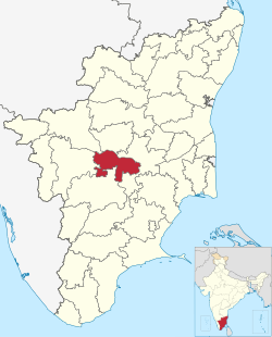
 Location in Tamil Nadu | |
| Coordinates: 10°57′28.8″N 78°4′48″E / 10.958000°N 78.08000°E | |
| Country | |
| State | |
| Municipal corporation | Karur |
| Municipality | |
| Town Panchayats | |
| Founded by | J. Jayalalithaa |
| Headquarters | Karur |
| Taluks | |
| Government | |
| • Collector | T. Prabhushankar, I.A.S |
| • SP | E. Sundaravathanam, I.P.S |
| Area | |
| • Total | 2,856 km2 (1,103 sq mi) |
| Population (2011) | |
| • Total | 1,064,493 |
| • Density | 373/km2 (970/sq mi) |
| Languages | |
| • Official | Tamil |
| Time zone | UTC+5:30 (IST) |
| PIN | 639xxx, 621xxx, 638xxx. |
| Telephone code | +91(0)4324, +91(0)4323, +91(0)4320 for Karur, Kulithalai and Aravakkurichi Circles Respectively. |
| Vehicle registration | TN 47[1] |
| Largest city | Karur |
| Sex ratio | 1015 ♂/♀ |
| Literacy | 81.74% |
| Lok Sabha constituency | 2 – Karur, Perambalur (Part) |
| Vidhan Sabha constituency | 4 |
| Central location: | 10°57′N 78°4′E / 10.950°N 78.067°E |
| Climate | Max 38c – Min 17c (Köppen) |
| Website | karur |
Karur District is one of the 38 districts (a district located centrally along the Kaveri and Amaravathi rivers) in the Indian state of Tamil Nadu. The main town in Karur District is the city of Karur, which is also the district headquarters. The district has a population of 1,064,493 with a sex-ratio of 1,015 females for every 1,000 males, according to 2011 census.


